Torysa (village)
Torysa | |
|---|---|
 | |
 Flag | |
 Torysa Location of Torysa in the Prešov Region  Torysa Location of Torysa in Slovakia | |
| Coordinates: 49°10′N 20°53′E / 49.17°N 20.88°E | |
| Country | |
| Region | |
| District | Sabinov District |
| First mentioned | 1265 |
| Area | |
• Total | 10.57 km2 (4.08 sq mi) |
| Elevation | 420 m (1,380 ft) |
| Population (2021)[3] | |
• Total | 1,619 |
| Time zone | UTC+1 (CET) |
| • Summer (DST) | UTC+2 (CEST) |
| Postal code | 827 6[2] |
| Area code | +421 51[2] |
| Car plate | SB |
| Website | www |
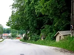
Torysa is a village and municipality in Sabinov District in the Prešov Region of north-eastern Slovakia.
History
In historical records the village was first mentioned in 1265. During the 18th century, the village had a local Catholic Bishop.
Geography
The municipality lies at an altitude of 449 metres and covers an area of 10.566 km2. It has a population of about 1470 people.
References
- ^ "Hustota obyvateľstva - obce [om7014rr_ukaz: Rozloha (Štvorcový meter)]". www.statistics.sk (in Slovak). Statistical Office of the Slovak Republic. 2022-03-31. Retrieved 2022-03-31.
- ^ a b c "Základná charakteristika". www.statistics.sk (in Slovak). Statistical Office of the Slovak Republic. 2015-04-17. Retrieved 2022-03-31.
- ^ "Počet obyvateľov podľa pohlavia - obce (ročne)". www.statistics.sk (in Slovak). Statistical Office of the Slovak Republic. 2022-03-31. Retrieved 2022-03-31.