Tysmenytsia (river)
| Tysmenytsia | |
|---|---|
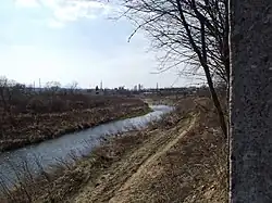 The river near Drohobych | |
| Native name | Тисмениця (Ukrainian) |
| Location | |
| Region | Lviv Oblast, Ukraine |
| Physical characteristics | |
| Source | |
| • location | near Boryslav |
| • coordinates | 49°13′51″N 23°25′15″E / 49.23083°N 23.42083°E |
| Mouth | Bystrytsia Tysmenytska |
• coordinates | 49°20′48″N 23°32′23″E / 49.34667°N 23.53972°E |
| Length | 49 km (30 mi) |
| Basin size | 650 km2 (250 sq mi) |
| Basin features | |
| Progression | Bystrytsia Tysmenytska→ Dniester→ Dniester Estuary→ Black Sea |
The Tysmenytsia (Ukrainian: Тисмениця) is a river in western Ukraine, and is a part of the Dniester basin. The river is a tributary of the Bystrytsia Tysmenytska and flows through parts of Lviv Oblast. [1]
The river has a total length of 49 kilometres (30 mi), and a basin size of 650 square kilometres (250 sq mi). A common activity at the river is fishing. [2]
References
- ^ "Paleogene Cross-section in Boryslav". Oil Cradle of Europe.
- ^ "Tysmenytsia River". Lviv Oblast tourism board.