Villiers-le-Duc
Villiers-le-Duc | |
|---|---|
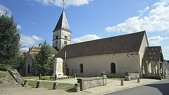 The church in Villiers-le-Duc | |
.svg.png) Coat of arms | |
Location of Villiers-le-Duc | |
 Villiers-le-Duc  Villiers-le-Duc | |
| Coordinates: 47°49′19″N 4°42′30″E / 47.8219°N 4.7083°E | |
| Country | France |
| Region | Bourgogne-Franche-Comté |
| Department | Côte-d'Or |
| Arrondissement | Montbard |
| Canton | Châtillon-sur-Seine |
| Intercommunality | Pays Châtillonnais |
| Government | |
| • Mayor (2020–2026) | Nicolas Schmit[1] |
Area 1 | 84.34 km2 (32.56 sq mi) |
| Population (2022)[2] | 111 |
| • Density | 1.3/km2 (3.4/sq mi) |
| Time zone | UTC+01:00 (CET) |
| • Summer (DST) | UTC+02:00 (CEST) |
| INSEE/Postal code | 21704 /21400 |
| Elevation | 252–417 m (827–1,368 ft) (avg. 250 m or 820 ft) |
| 1 French Land Register data, which excludes lakes, ponds, glaciers > 1 km2 (0.386 sq mi or 247 acres) and river estuaries. | |
Villiers-le-Duc (French pronunciation: [vilje lə dyk]) is a commune in the Côte-d'Or department in eastern France.
Population
| Year | Pop. | ±% |
|---|---|---|
| 1962 | 118 | — |
| 1968 | 129 | +9.3% |
| 1975 | 112 | −13.2% |
| 1982 | 100 | −10.7% |
| 1990 | 118 | +18.0% |
| 1999 | 135 | +14.4% |
| 2008 | 110 | −18.5% |
See also
References
- ^ "Répertoire national des élus: les maires". data.gouv.fr, Plateforme ouverte des données publiques françaises (in French). 2 December 2020.
- ^ "Populations de référence 2022" (in French). The National Institute of Statistics and Economic Studies. 19 December 2024.
Wikimedia Commons has media related to Villiers-le-Duc.