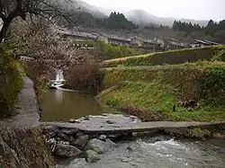
Yamato River
| Yamato River | |
|---|---|
 | |
| Native name | 大和川 (Japanese) |
| Location | |
| Country | Japan |
| Region | Kansai region |
| Physical characteristics | |
| Source | |
| • location | Kaikira-yama, Nara Prefecture |
| • elevation | 822 m (2,697 ft) |
| Mouth | Osaka Bay |
• coordinates | 34°36′30″N 135°26′28″E / 34.6084°N 135.4410°E |
| Length | 68 km (42 mi) |
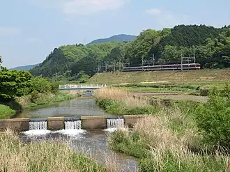
The Yamato River (大和川, Yamato-gawa) is a river that flows through Nara Prefecture and Osaka Prefecture, Japan. It is designated Class A by the Ministry of Land, Infrastructure, Transport and Tourism (MLIT).
The river flows via towns:
Since 1704, the river was reconfigured, originally its flow was north from the Ishikawa River confluence point, where it joined the Shirinashi River and Kizu River.[1]
At the river mouth is a densely populated area and the river forms a natural border between Osaka and Sakai.[2]
See also
Wikimedia Commons has media related to Yamato River.
References
- ^ "Yamato River". Retrieved 28 March 2017.
- ^ Davidson, Neil (4 January 2014). "Yamato River, Osaka". Retrieved 28 March 2017.
Article contains translated text from 大和川 on the Japanese Wikipedia retrieved on 26 March 2017.
| |||||||||||||||
| |||||||||||||||
| |||||||||||||||
| |||||||||||||||
| |||||||||||||||