Estavar
Estavar | |
|---|---|
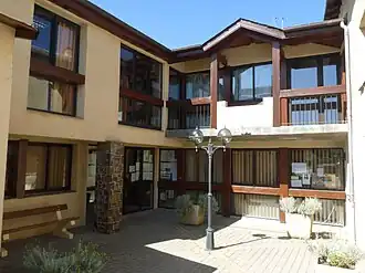 The town hall in Estavar | |
 Coat of arms | |
Location of Estavar | |
 Estavar  Estavar | |
| Coordinates: 42°28′17″N 1°59′53″E / 42.4714°N 1.9981°E | |
| Country | France |
| Region | Occitania |
| Department | Pyrénées-Orientales |
| Arrondissement | Prades |
| Canton | Les Pyrénées catalanes |
| Intercommunality | Pyrénées Cerdagne |
| Government | |
| • Mayor (2020–2026) | Laurent Leygue[1] |
Area 1 | 9.24 km2 (3.57 sq mi) |
| Population (2022)[2] | 455 |
| • Density | 49/km2 (130/sq mi) |
| Time zone | UTC+01:00 (CET) |
| • Summer (DST) | UTC+02:00 (CEST) |
| INSEE/Postal code | 66072 /66800 |
| Elevation | 1,200–1,659 m (3,937–5,443 ft) (avg. 1,293 m or 4,242 ft) |
| 1 French Land Register data, which excludes lakes, ponds, glaciers > 1 km2 (0.386 sq mi or 247 acres) and river estuaries. | |
Estavar (French pronunciation: [ɛstavaʁ] ⓘ; Catalan: Estavar) is a commune in the Pyrénées-Orientales department in southern France.[3]
Geography
Estavar is located in the canton of Les Pyrénées catalanes and in the arrondissement of Prades. Estavar station has rail connections to Villefranche-de-Conflent and Latour-de-Carol.

Places adjacent to Estavar | |
|---|---|
Population
| Year | Pop. | ±% p.a. |
|---|---|---|
| 1968 | 178 | — |
| 1975 | 206 | +2.11% |
| 1982 | 281 | +4.54% |
| 1990 | 358 | +3.07% |
| 1999 | 409 | +1.49% |
| 2007 | 470 | +1.75% |
| 2012 | 408 | −2.79% |
| 2017 | 472 | +2.96% |
| Source: INSEE[4] | ||
See also
References
- ^ "Répertoire national des élus: les maires". data.gouv.fr, Plateforme ouverte des données publiques françaises (in French). 2 December 2020.
- ^ "Populations de référence 2022" (in French). The National Institute of Statistics and Economic Studies. 19 December 2024.
- ^ INSEE commune file
- ^ Population en historique depuis 1968, INSEE
Wikimedia Commons has media related to Estavar.