Saint-Marsal
Saint-Marsal Sant Marçal | |
|---|---|
 A postcard view of Saint-Marsal, in the early 20th century | |
.svg.png) Coat of arms | |
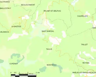
Location of Saint-Marsal | |
 Saint-Marsal  Saint-Marsal | |
| Coordinates: 42°32′19″N 2°37′19″E / 42.5386°N 2.6219°E | |
| Country | France |
| Region | Occitania |
| Department | Pyrénées-Orientales |
| Arrondissement | Céret |
| Canton | Le Canigou |
| Intercommunality | Haut Vallespir |
| Government | |
| • Mayor (2021–2026) | Guy Metivier[1] |
Area 1 | 15.36 km2 (5.93 sq mi) |
| Population (2022)[2] | 73 |
| • Density | 4.8/km2 (12/sq mi) |
| Time zone | UTC+01:00 (CET) |
| • Summer (DST) | UTC+02:00 (CEST) |
| INSEE/Postal code | 66183 /66110 |
| Elevation | 260–1,477 m (853–4,846 ft) (avg. 720 m or 2,360 ft) |
| 1 French Land Register data, which excludes lakes, ponds, glaciers > 1 km2 (0.386 sq mi or 247 acres) and river estuaries. | |
Saint-Marsal (French pronunciation: [sɛ̃ maʁsal] ⓘ; Catalan: Sant Marçal) is a commune in the Pyrénées-Orientales department in southern France.
Geography
Saint-Marsal is located in the canton of Le Canigou and in the arrondissement of Céret.
Population
| Year | Pop. | ±% p.a. |
|---|---|---|
| 1968 | 117 | — |
| 1975 | 108 | −1.14% |
| 1982 | 104 | −0.54% |
| 1990 | 77 | −3.69% |
| 1999 | 85 | +1.10% |
| 2007 | 103 | +2.43% |
| 2012 | 91 | −2.45% |
| 2017 | 71 | −4.84% |
| Source: INSEE[3] | ||
See also
References
- ^ "Répertoire national des élus: les maires" (in French). data.gouv.fr, Plateforme ouverte des données publiques françaises. 4 May 2022.
- ^ "Populations de référence 2022" (in French). The National Institute of Statistics and Economic Studies. 19 December 2024.
- ^ Population en historique depuis 1968, INSEE
Wikimedia Commons has media related to Saint-Marsal.