Grafenbach-Sankt Valentin
Grafenbach-St. Valentin | |
|---|---|
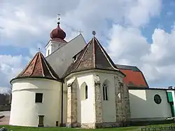 The parish church | |
 Coat of arms | |
 Grafenbach-St. Valentin Location within Austria | |
| Coordinates: 47°41′N 16°0′E / 47.683°N 16.000°E | |
| Country | Austria |
| State | Lower Austria |
| District | Neunkirchen |
| Government | |
| • Mayor | Sylivia Kögler (SPÖ) |
| Area | |
• Total | 13.9 km2 (5.4 sq mi) |
| Elevation | 430 m (1,410 ft) |
| Population (2018-01-01)[2] | |
• Total | 2,264 |
| • Density | 160/km2 (420/sq mi) |
| Time zone | UTC+1 (CET) |
| • Summer (DST) | UTC+2 (CEST) |
| Postal code | 2632 |
| Area code | 02630 |
| Vehicle registration | NK |
| Website | www.grafenbach.at |
Grafenbach-Sankt Valentin is a town in the district of Neunkirchen in the Austrian state of Lower Austria.
Geography
Grafenbach_St. Valtentin lies southwest of Ternitz in the Schwarzatal. It has an area of 13.9 km2. 15.54% of its area is forested.
History
In ancient times, the municipality was part of the Roman province of Noricum. There is a 9th-century burial ground near Grafenbach.
Population
| Year | Pop. | ±% |
|---|---|---|
| 1869 | 746 | — |
| 1880 | 895 | +20.0% |
| 1890 | 1,198 | +33.9% |
| 1900 | 1,466 | +22.4% |
| 1910 | 1,755 | +19.7% |
| 1923 | 1,698 | −3.2% |
| 1934 | 1,762 | +3.8% |
| 1939 | 1,786 | +1.4% |
| 1951 | 1,746 | −2.2% |
| 1961 | 1,856 | +6.3% |
| 1971 | 2,003 | +7.9% |
| 1981 | 1,969 | −1.7% |
| 1991 | 2,233 | +13.4% |
| 2001 | 2,303 | +3.1% |
| 2011 | 2,248 | −2.4% |
References
- ^ "Dauersiedlungsraum der Gemeinden Politischen Bezirke und Bundesländer - Gebietsstand 1.1.2018". Statistics Austria. Retrieved 10 March 2019.
- ^ "Einwohnerzahl 1.1.2018 nach Gemeinden mit Status, Gebietsstand 1.1.2018". Statistics Austria. Retrieved 9 March 2019.