Thomasberg
Thomasberg | |
|---|---|
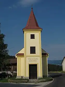 Wiesfleck chapel in Thomasberg | |
 Coat of arms | |
 Thomasberg Location within Austria | |
| Coordinates: 47°34′N 16°8′E / 47.567°N 16.133°E | |
| Country | Austria |
| State | Lower Austria |
| District | Neunkirchen |
| Government | |
| • Mayor | Engelbert Ringhofer |
| Area | |
• Total | 28.99 km2 (11.19 sq mi) |
| Elevation | 541 m (1,775 ft) |
| Population (2018-01-01)[2] | |
• Total | 1,284 |
| • Density | 44/km2 (110/sq mi) |
| Time zone | UTC+1 (CET) |
| • Summer (DST) | UTC+2 (CEST) |
| Postal code | 2840 |
| Area code | 02644 |
Thomasberg is a town in the district of Neunkirchen in the Austrian state of Lower Austria.
Population
| Year | Pop. | ±% |
|---|---|---|
| 1869 | 1,331 | — |
| 1880 | 1,472 | +10.6% |
| 1890 | 1,385 | −5.9% |
| 1900 | 1,354 | −2.2% |
| 1910 | 1,420 | +4.9% |
| 1923 | 1,389 | −2.2% |
| 1934 | 1,392 | +0.2% |
| 1939 | 1,316 | −5.5% |
| 1951 | 1,252 | −4.9% |
| 1961 | 1,310 | +4.6% |
| 1971 | 1,319 | +0.7% |
| 1981 | 1,359 | +3.0% |
| 1991 | 1,262 | −7.1% |
| 2001 | 1,239 | −1.8% |
| 2011 | 1,212 | −2.2% |
References
- ^ "Dauersiedlungsraum der Gemeinden Politischen Bezirke und Bundesländer - Gebietsstand 1.1.2018". Statistics Austria. Retrieved 10 March 2019.
- ^ "Einwohnerzahl 1.1.2018 nach Gemeinden mit Status, Gebietsstand 1.1.2018". Statistics Austria. Retrieved 9 March 2019.