Krašlovice
Krašlovice | |
|---|---|
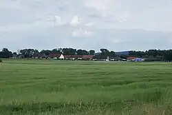 General view | |
 Krašlovice Location in the Czech Republic | |
| Coordinates: 49°10′0″N 14°7′57″E / 49.16667°N 14.13250°E | |
| Country | |
| Region | South Bohemian |
| District | Strakonice |
| First mentioned | 1262 |
| Area | |
• Total | 5.31 km2 (2.05 sq mi) |
| Elevation | 398 m (1,306 ft) |
| Population (2025-01-01)[1] | |
• Total | 163 |
| • Density | 31/km2 (80/sq mi) |
| Time zone | UTC+1 (CET) |
| • Summer (DST) | UTC+2 (CEST) |
| Postal code | 389 01 |
| Website | www |
Krašlovice is a municipality and village in Strakonice District in the South Bohemian Region of the Czech Republic. It has about 200 inhabitants.
Krašlovice lies approximately 20 kilometres (12 mi) south-east of Strakonice, 33 km (21 mi) north-west of České Budějovice, and 105 km (65 mi) south of Prague.
Administrative division
Krašlovice consists of two municipal parts (in brackets population according to the 2021 census):[2]
- Krašlovice (109)
- Vitice (32)
Demographics
| Year | Pop. | ±% |
|---|---|---|
| 1869 | 375 | — |
| 1880 | 359 | −4.3% |
| 1890 | 327 | −8.9% |
| 1900 | 338 | +3.4% |
| 1910 | 329 | −2.7% |
| 1921 | 318 | −3.3% |
| 1930 | 325 | +2.2% |
| 1950 | 218 | −32.9% |
| 1961 | 195 | −10.6% |
| 1970 | 152 | −22.1% |
| 1980 | 177 | +16.4% |
| 1991 | 180 | +1.7% |
| 2001 | 137 | −23.9% |
| 2011 | 149 | +8.8% |
| 2021 | 141 | −5.4% |
| Source: Censuses[3][4] | ||
References
- ^ "Population of Municipalities – 1 January 2025". Czech Statistical Office. 2025-05-16.
- ^ "Public Census 2021 – basic data". Public Database (in Czech). Czech Statistical Office. 2022.
- ^ "Historický lexikon obcí České republiky 1869–2011" (in Czech). Czech Statistical Office. 2015-12-21.
- ^ "Population Census 2021: Population by sex". Public Database. Czech Statistical Office. 2021-03-27.
External links
Wikimedia Commons has media related to Krašlovice.