Neuvireuil
Neuvireuil | |
|---|---|
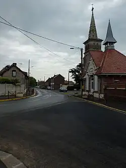 The main road of Neuvireuil | |
 Coat of arms | |
Location of Neuvireuil | |
 Neuvireuil  Neuvireuil | |
| Coordinates: 50°21′09″N 2°54′40″E / 50.3525°N 2.9111°E | |
| Country | France |
| Region | Hauts-de-France |
| Department | Pas-de-Calais |
| Arrondissement | Arras |
| Canton | Brebières |
| Intercommunality | CC Osartis Marquion |
| Government | |
| • Mayor (2020–2026) | Michel Houvenaeghel[1] |
Area 1 | 4.34 km2 (1.68 sq mi) |
| Population (2022)[2] | 575 |
| • Density | 130/km2 (340/sq mi) |
| Time zone | UTC+01:00 (CET) |
| • Summer (DST) | UTC+02:00 (CEST) |
| INSEE/Postal code | 62612 /62580 |
| Elevation | 40–61 m (131–200 ft) (avg. 55 m or 180 ft) |
| 1 French Land Register data, which excludes lakes, ponds, glaciers > 1 km2 (0.386 sq mi or 247 acres) and river estuaries. | |
Neuvireuil (French pronunciation: [nøviʁœj]) is a commune in the Pas-de-Calais department in the Hauts-de-France region of France.[3]
Geography
Neuvireuil is situated 7 miles (11 km) northeast of Arras, at the junction of the D46 and D48 roads.
Population
| Year | Pop. | ±% p.a. |
|---|---|---|
| 1968 | 362 | — |
| 1975 | 330 | −1.31% |
| 1982 | 424 | +3.65% |
| 1990 | 474 | +1.40% |
| 1999 | 451 | −0.55% |
| 2007 | 458 | +0.19% |
| 2012 | 495 | +1.57% |
| 2017 | 574 | +3.01% |
| Source: INSEE[4] | ||
Places of interest
- The seventeenth century church of St. Amé, rebuilt after World War I.
See also
References
- ^ "Répertoire national des élus: les maires". data.gouv.fr, Plateforme ouverte des données publiques françaises (in French). 9 August 2021.
- ^ "Populations de référence 2022" (in French). The National Institute of Statistics and Economic Studies. 19 December 2024.
- ^ INSEE commune file
- ^ Population en historique depuis 1968, INSEE
External links
Wikimedia Commons has media related to Neuvireuil.