Oisy-le-Verger
Oisy-le-Verger | |
|---|---|
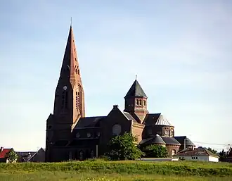 The church of Oisy-le-Verger | |
 Coat of arms | |
Location of Oisy-le-Verger | |
 Oisy-le-Verger  Oisy-le-Verger | |
| Coordinates: 50°15′03″N 3°07′29″E / 50.2508°N 3.1247°E / 50.2508; 3.1247 | |
| Country | France |
| Region | Hauts-de-France |
| Department | Pas-de-Calais |
| Arrondissement | Arras |
| Canton | Bapaume |
| Intercommunality | CC Osartis Marquion |
| Government | |
| • Mayor (2020–2026) | Marie-Christine Guenot[1] |
Area 1 | 11.36 km2 (4.39 sq mi) |
| Population (2022)[2] | 1,200 |
| • Density | 110/km2 (270/sq mi) |
| Time zone | UTC+01:00 (CET) |
| • Summer (DST) | UTC+02:00 (CEST) |
| INSEE/Postal code | 62638 /62860 |
| Elevation | 32–77 m (105–253 ft) (avg. 78 m or 256 ft) |
| 1 French Land Register data, which excludes lakes, ponds, glaciers > 1 km2 (0.386 sq mi or 247 acres) and river estuaries. | |
Oisy-le-Verger (French pronunciation: [wazi lə vɛʁʒe]) is a commune in the Pas-de-Calais department in the Hauts-de-France region of France[3] 15 miles (24 km) east of Arras.
Population
| Year | Pop. | ±% p.a. |
|---|---|---|
| 1968 | 1,328 | — |
| 1975 | 1,310 | −0.19% |
| 1982 | 1,278 | −0.35% |
| 1990 | 1,301 | +0.22% |
| 1999 | 1,260 | −0.36% |
| 2007 | 1,285 | +0.25% |
| 2012 | 1,251 | −0.53% |
| 2017 | 1,217 | −0.55% |
| Source: INSEE[4] | ||
See also
References
- ^ "Répertoire national des élus: les maires" (in French). data.gouv.fr, Plateforme ouverte des données publiques françaises. 13 September 2022.
- ^ "Populations de référence 2022" (in French). The National Institute of Statistics and Economic Studies. 19 December 2024.
- ^ INSEE commune file
- ^ Population en historique depuis 1968, INSEE
Wikimedia Commons has media related to Oisy-le-Verger.
Authority control databases | |
|---|---|
| International | |
| National | |
This article is issued from Wikipedia. The text is available under Creative Commons Attribution-Share Alike 4.0 unless otherwise noted. Additional terms may apply for the media files.