Gémonval
Gémonval | |
|---|---|
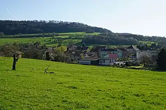 A general view of Gémonval | |
Location of Gémonval | |
 Gémonval  Gémonval | |
| Coordinates: 47°31′59″N 6°35′21″E / 47.5331°N 6.5892°E | |
| Country | France |
| Region | Bourgogne-Franche-Comté |
| Department | Doubs |
| Arrondissement | Montbéliard |
| Canton | Bavans |
| Government | |
| • Mayor (2020–2026) | Fabrice Vrillacq[1] |
Area 1 | 3.39 km2 (1.31 sq mi) |
| Population (2022)[2] | 82 |
| • Density | 24/km2 (63/sq mi) |
| Time zone | UTC+01:00 (CET) |
| • Summer (DST) | UTC+02:00 (CEST) |
| INSEE/Postal code | 25264 /25250 |
| Elevation | 305–513 m (1,001–1,683 ft) |
| 1 French Land Register data, which excludes lakes, ponds, glaciers > 1 km2 (0.386 sq mi or 247 acres) and river estuaries. | |
Gémonval (French pronunciation: [ʒemɔ̃val]) is a commune in the Doubs department in the Bourgogne-Franche-Comté region in eastern France.
Coal mines were operated in the village between 1826 and 1944.
-
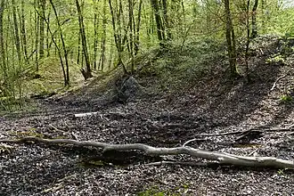
 Mine shaft of Elisabeth.
 -
 Mine shaft de la Houillère.
 -
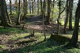 Mine shaft des Essarts.
 -
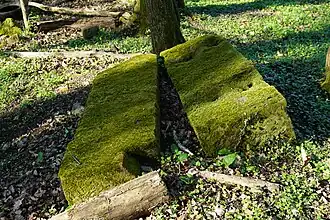 Plinth of steam machine in mine shaft des Essarts.
-
 A sectional view of the mine-schaft #3.
ht : "houille tendre" (coal),
hg (gray) : "houille gypseuse" (coal).
Population
| Year | Pop. | ±% |
|---|---|---|
| 1962 | 76 | — |
| 1968 | 92 | +21.1% |
| 1975 | 75 | −18.5% |
| 1982 | 86 | +14.7% |
| 1990 | 100 | +16.3% |
| 1999 | 75 | −25.0% |
| 2008 | 88 | +17.3% |
| 2012 | 77 | −12.5% |
See also
References
- ^ "Répertoire national des élus: les maires". data.gouv.fr, Plateforme ouverte des données publiques françaises (in French). 2 December 2020.
- ^ "Populations de référence 2022" (in French). The National Institute of Statistics and Economic Studies. 19 December 2024.
Wikimedia Commons has media related to Gémonval.