Joncels
Joncels | |
|---|---|
 Church | |
.svg.png) Coat of arms | |
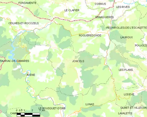
Location of Joncels | |
 Joncels  Joncels | |
| Coordinates: 43°44′18″N 3°11′43″E / 43.7383°N 3.1953°E | |
| Country | France |
| Region | Occitania |
| Department | Hérault |
| Arrondissement | Béziers |
| Canton | Clermont-l'Hérault |
| Government | |
| • Mayor (2020–2026) | Rémy Paillès[1] |
Area 1 | 46.24 km2 (17.85 sq mi) |
| Population (2022)[2] | 261 |
| • Density | 5.6/km2 (15/sq mi) |
| Time zone | UTC+01:00 (CET) |
| • Summer (DST) | UTC+02:00 (CEST) |
| INSEE/Postal code | 34121 /34650 |
| Elevation | 290–835 m (951–2,740 ft) (avg. 380 m or 1,250 ft) |
| 1 French Land Register data, which excludes lakes, ponds, glaciers > 1 km2 (0.386 sq mi or 247 acres) and river estuaries. | |
Joncels is a commune in the Hérault département in the Occitanie region in southern France.
Population
| Year | Pop. | ±% |
|---|---|---|
| 1962 | 247 | — |
| 1968 | 222 | −10.1% |
| 1975 | 198 | −10.8% |
| 1982 | 203 | +2.5% |
| 1990 | 222 | +9.4% |
| 1999 | 227 | +2.3% |
| 2006 | 257 | +13.2% |
| Source: Ldh/EHESS/Cassini[3] | ||
See also
References
- ^ "Répertoire national des élus: les maires". data.gouv.fr, Plateforme ouverte des données publiques françaises (in French). 2 December 2020.
- ^ "Populations de référence 2022" (in French). The National Institute of Statistics and Economic Studies. 19 December 2024.
- ^ Des villages de Cassini aux communes d'aujourd'hui: Commune data sheet Joncels, EHESS (in French).
Wikimedia Commons has media related to Joncels.