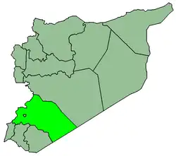
Al-Sahel (Arabic: السحل, also transliterated As-Sahel and As-Sehel) is a Syrian village in the An-Nabek District of the Rif Dimashq Governorate. According to the Syria Central Bureau of Statistics (CBS), al-Sahel had a population of 5,677 in the 2004 census.[1] Its inhabitants are predominantly Sunni Muslims.[2]
Nearby cities and towns
Weather
| Season | Temperature, °C | Rainfall, cm | Wind, km/h |
| Fall | 15.3 | 0.8 | 5 |
| Winter | 2.5 | 2.7 | 5.5 |
| Spring | 13.5 | 0.0 | 6 |
| Summer | 22.5 | 0.0 | 5 |
References
Bibliography
External links
|
|---|
|
|---|
Kiswah
Subdistrict | |
|---|
Babbila
Subdistrict | |
|---|
Jaramana
Subdistrict | |
|---|
Malihah
Subdistrict | |
|---|
Kafr Batna
Subdistrict | |
|---|
Arbin
Subdistrict | |
|---|
|
| |
|
|---|
Douma
Subdistrict | |
|---|
Harasta
Subdistrict | |
|---|
Sabe Biyar
Subdistrict | |
|---|
Dumayr
Subdistrict | |
|---|
Nashabiyeh
Subdistrict | |
|---|
Ghazlaniyeh
Subdistrict | |
|---|
Harran al-Awamid
Subdistrict | |
|---|
|
|
|
|---|
Qutayfah
Subdistrict | |
|---|
Jayrud
Subdistrict | |
|---|
Maloula
Subdistrict | |
|---|
Raheiba
Subdistrict | |
|---|
|
|
|
|---|
Al-Tall
Subdistrict | |
|---|
Sednaya
Subdistrict | |
|---|
Rankous
Subdistrict | |
|---|
|
|
|
|---|
Yabroud
Subdistrict | |
|---|
Assal al-Ward
Subdistrict | |
|---|
|
|
|
|---|
An-Nabek
Subdistrict | |
|---|
Deir Atiyeh
Subdistrict | |
|---|
Qara
Subdistrict | |
|---|
|
|
|
|---|
Al-Zabadani
Subdistrict | |
|---|
Madaya
Subdistrict | |
|---|
Serghaya
Subdistrict | |
|---|
|
|
|
|---|
Qatana
Subdistrict | |
|---|
Beit Jann
Subdistrict | |
|---|
Sa'sa
Subdistrict | |
|---|
|
|
|
|---|
Darayya
Subdistrict | |
|---|
Sahnaya
Subdistrict | |
|---|
Hajar al-Aswad
Subdistrict | |
|---|
|
|
|
|---|
Qudsaya
Subdistrict | |
|---|
ad-Dimas
Subdistrict | |
|---|
Ein al-Fijeh
Subdistrict | |
|---|
|
|