Berriozábal
Berriozábal | |
|---|---|
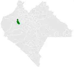 Municipality of Berriozábal in Chiapas | |
 Berriozábal Location in Mexico | |
| Coordinates: 16°48′N 93°16′W / 16.800°N 93.267°W | |
| Country | |
| State | Chiapas |
| Area | |
• Total | 136 sq mi (352 km2) |
| • City | 3.27 sq mi (8.46 km2) |
| Population (2020 census)[1] | |
• Total | 64,632 |
| • Density | 480/sq mi (180/km2) |
| • City | 36,084 |
| • City density | 11,000/sq mi (4,300/km2) |
| • Gender | 31,914 males and 32,718 females |
| Climate | Aw |
Berriozábal is a city and municipality in the Mexican state of Chiapas, in southern Mexico. It covers an area of 352 km2.
In 2010, the municipality had a total population of 43,179,[2] up from 28,719 in 2005.[3]
In 2010, the city of Berriozábal had a population of 28,128.[2] Beside the city of Berriozábal, the municipality had 485 localities, the largest of which (with 2010 populations in parentheses) were: Santa Inés Buenavista (1,559), Ignacio Zaragoza (1,354), and Las Maravillas (1,339), classified as rural.[2]
Climate
| Climate data for Berriozábal (1991–2020) | |||||||||||||
|---|---|---|---|---|---|---|---|---|---|---|---|---|---|
| Month | Jan | Feb | Mar | Apr | May | Jun | Jul | Aug | Sep | Oct | Nov | Dec | Year |
| Record high °C (°F) | 36.5 (97.7) | 39.5 (103.1) | 38.0 (100.4) | 39.5 (103.1) | 39.5 (103.1) | 37.5 (99.5) | 34.5 (94.1) | 36.0 (96.8) | 33.0 (91.4) | 33.5 (92.3) | 37.5 (99.5) | 37.0 (98.6) | 39.5 (103.1) |
| Mean daily maximum °C (°F) | 25.1 (77.2) | 27.2 (81.0) | 28.6 (83.5) | 30.5 (86.9) | 30.3 (86.5) | 28.5 (83.3) | 28.4 (83.1) | 28.5 (83.3) | 27.7 (81.9) | 26.9 (80.4) | 25.8 (78.4) | 25.2 (77.4) | 27.7 (81.9) |
| Daily mean °C (°F) | 19.8 (67.6) | 21.2 (70.2) | 22.4 (72.3) | 24.1 (75.4) | 24.5 (76.1) | 23.5 (74.3) | 23.4 (74.1) | 23.5 (74.3) | 23.1 (73.6) | 22.2 (72.0) | 20.8 (69.4) | 19.8 (67.6) | 22.4 (72.2) |
| Mean daily minimum °C (°F) | 14.5 (58.1) | 15.2 (59.4) | 16.1 (61.0) | 17.7 (63.9) | 18.8 (65.8) | 18.6 (65.5) | 18.4 (65.1) | 18.6 (65.5) | 18.5 (65.3) | 17.5 (63.5) | 15.9 (60.6) | 14.5 (58.1) | 17.0 (62.7) |
| Record low °C (°F) | 1.7 (35.1) | 8.5 (47.3) | 7.0 (44.6) | 7.5 (45.5) | 2.5 (36.5) | 12.0 (53.6) | 2.5 (36.5) | 2.5 (36.5) | 0.0 (32.0) | 1.0 (33.8) | 2.5 (36.5) | 5.0 (41.0) | 0.0 (32.0) |
| Average precipitation mm (inches) | 5.5 (0.22) | 3.7 (0.15) | 2.8 (0.11) | 17.0 (0.67) | 76.6 (3.02) | 218.6 (8.61) | 143.6 (5.65) | 184.3 (7.26) | 188.8 (7.43) | 103.2 (4.06) | 21.7 (0.85) | 8.0 (0.31) | 973.8 (38.34) |
| Source: Servicio Meteorologico Nacional[4][5] | |||||||||||||
References
- ^ Citypopulation.de
- ^ a b c "Berriozábal". Catálogo de Localidades. Secretaría de Desarrollo Social (SEDESOL). Archived from the original on 4 March 2016. Retrieved 23 April 2014.
- ^ "Berriozábal". Enciclopedia de los Municipios de México. Instituto Nacional para el Federalismo y el Desarrollo Municipal Gobierno del Estado de Chiapas. Archived from the original on September 27, 2007. Retrieved July 25, 2008.
- ^ "Estado de Chiapas-Estacion: BERRIOZABAL". Normales Climatologicas 1991–2020 (in Spanish). Servicio Meteorológico Nacional. Retrieved 15 February 2025.
- ^ "Extreme for Berriozábal" (in Spanish). Servicio Meteorológico Nacional. Retrieved May 8, 2015.
