Bochil
Bochil | |
|---|---|
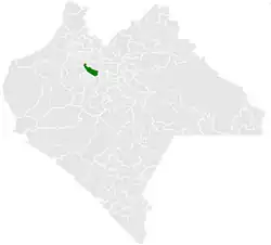 Municipality of Bochil in Chiapas | |
 Bochil Location in Mexico | |
| Coordinates: 16°59′N 92°55′W / 16.983°N 92.917°W | |
| Country | |
| State | Chiapas |
| Area | |
• Total | 372.7 km2 (143.9 sq mi) |
| Population (2010) | |
• Total | 30,642 |
| Climate | Aw |
Bochil is a city and municipality in the Mexican state of Chiapas, in southern Mexico. It covers an area of 372.7 km². Bochil serves as the head town for the Second Federal Electoral District of Chiapas.
As of 2010, the municipality had a total population of 30,642,[1] up from 22,722 as of 2005.[2]
As of 2010, the city of Bochil had a population of 12,404.[1] Other than the city of Bochil, the municipality had 83 localities, the largest of which (with 2010 populations in parentheses) were: Ajiló (1,271), El Copal (1,133), and Luis Espinoza (1,107), classified as rural.[1]
Climate
| Climate data for Bochil (1991–2020) | |||||||||||||
|---|---|---|---|---|---|---|---|---|---|---|---|---|---|
| Month | Jan | Feb | Mar | Apr | May | Jun | Jul | Aug | Sep | Oct | Nov | Dec | Year |
| Record high °C (°F) | 37.0 (98.6) | 36.5 (97.7) | 39.0 (102.2) | 38.5 (101.3) | 39.0 (102.2) | 37.0 (98.6) | 36.0 (96.8) | 39.0 (102.2) | 36.5 (97.7) | 38.0 (100.4) | 39.0 (102.2) | 38.0 (100.4) | 39.0 (102.2) |
| Mean daily maximum °C (°F) | 24.2 (75.6) | 26.2 (79.2) | 28.6 (83.5) | 30.5 (86.9) | 30.4 (86.7) | 28.7 (83.7) | 28.5 (83.3) | 28.4 (83.1) | 27.6 (81.7) | 26.5 (79.7) | 24.9 (76.8) | 24.3 (75.7) | 27.4 (81.3) |
| Daily mean °C (°F) | 17.5 (63.5) | 18.9 (66.0) | 20.8 (69.4) | 22.8 (73.0) | 23.4 (74.1) | 22.7 (72.9) | 22.4 (72.3) | 22.3 (72.1) | 22.0 (71.6) | 21.0 (69.8) | 19.2 (66.6) | 17.8 (64.0) | 20.9 (69.6) |
| Mean daily minimum °C (°F) | 10.8 (51.4) | 11.6 (52.9) | 13.1 (55.6) | 15.1 (59.2) | 16.4 (61.5) | 16.6 (61.9) | 16.4 (61.5) | 16.2 (61.2) | 16.3 (61.3) | 15.4 (59.7) | 13.4 (56.1) | 11.3 (52.3) | 14.4 (57.9) |
| Record low °C (°F) | 0.0 (32.0) | 0.5 (32.9) | 1.0 (33.8) | 4.0 (39.2) | 10.0 (50.0) | 10.0 (50.0) | 1.4 (34.5) | 1.0 (33.8) | 12.0 (53.6) | 7.0 (44.6) | 3.0 (37.4) | 0.5 (32.9) | 0.0 (32.0) |
| Average precipitation mm (inches) | 14.7 (0.58) | 11.3 (0.44) | 14.3 (0.56) | 39.6 (1.56) | 119.7 (4.71) | 235.5 (9.27) | 158.8 (6.25) | 240.9 (9.48) | 251.8 (9.91) | 139.6 (5.50) | 47.1 (1.85) | 20.8 (0.82) | 1,294.1 (50.95) |
| Source: Servicio Meteorologico Nacional[3][4] | |||||||||||||
References
- ^ a b c "Bochil". Catálogo de Localidades. Secretaría de Desarrollo Social (SEDESOL). Retrieved 23 April 2014.
- ^ "Bochil". Enciclopedia de los Municipios de México. Instituto Nacional para el Federalismo y el Desarrollo Municipal / Gobierno del Estado de Chiapas. Archived from the original on 2007-09-27. Retrieved 2008-07-25.
- ^ "Estado de Chiapas-Estacion: BOCHIL". Normales Climatologicas 1991–2020 (in Spanish). Servicio Meteorológico Nacional. Retrieved 15 February 2025.
- ^ "Extreme for Bochil" (in Spanish). Servicio Meteorológico Nacional. Retrieved May 8, 2015.
