Couturelle
Couturelle | |
|---|---|
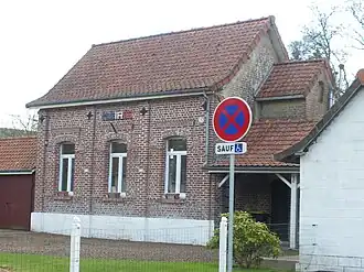 The town hall of Couturelle | |
 Coat of arms | |
Location of Couturelle | |
 Couturelle  Couturelle | |
| Coordinates: 50°12′33″N 2°30′03″E / 50.2092°N 2.5008°E | |
| Country | France |
| Region | Hauts-de-France |
| Department | Pas-de-Calais |
| Arrondissement | Arras |
| Canton | Avesnes-le-Comte |
| Intercommunality | CC Campagnes de l'Artois |
| Government | |
| • Mayor (2020–2026) | Hugues Legoux[1] |
Area 1 | 2.1 km2 (0.8 sq mi) |
| Population (2022)[2] | 76 |
| • Density | 36/km2 (94/sq mi) |
| Time zone | UTC+01:00 (CET) |
| • Summer (DST) | UTC+02:00 (CEST) |
| INSEE/Postal code | 62253 /62158 |
| Elevation | 130–171 m (427–561 ft) (avg. 159 m or 522 ft) |
| 1 French Land Register data, which excludes lakes, ponds, glaciers > 1 km2 (0.386 sq mi or 247 acres) and river estuaries. | |
Couturelle (French pronunciation: [kutyʁɛl]) is a commune in the Pas-de-Calais department in the Hauts-de-France region of France.[3]
Geography
A small farming village located 15 miles (25 km) southwest of Arras at the junction of the D25 and D23 roads, on the border with the department of the Somme.
Population
| Year | Pop. | ±% p.a. |
|---|---|---|
| 1968 | 126 | — |
| 1975 | 108 | −2.18% |
| 1982 | 102 | −0.81% |
| 1990 | 106 | +0.48% |
| 1999 | 87 | −2.17% |
| 2007 | 95 | +1.11% |
| 2012 | 99 | +0.83% |
| 2017 | 65 | −8.07% |
| Source: INSEE[4] | ||
Places of interest
- The church of St.Thomas, dating from the nineteenth century.
- The Commonwealth War Graves Commission cemetery.
- Remains of a 13th-century castle.
- The eighteenth-century chateau.
See also
References
- ^ "Répertoire national des élus: les maires". data.gouv.fr, Plateforme ouverte des données publiques françaises (in French). 9 August 2021.
- ^ "Populations de référence 2022" (in French). The National Institute of Statistics and Economic Studies. 19 December 2024.
- ^ INSEE commune file
- ^ Population en historique depuis 1968, INSEE
External links
Wikimedia Commons has media related to Couturelle.