Vacqueriette-Erquières
Vacqueriette-Erquières | |
|---|---|
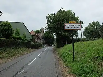 The road into Vacqueriette-Erquières | |
.svg.png) Coat of arms | |
Location of Vacqueriette-Erquières | |
 Vacqueriette-Erquières  Vacqueriette-Erquières | |
| Coordinates: 50°19′30″N 2°04′42″E / 50.325°N 2.0783°E | |
| Country | France |
| Region | Hauts-de-France |
| Department | Pas-de-Calais |
| Arrondissement | Montreuil |
| Canton | Auxi-le-Château |
| Intercommunality | CC des 7 Vallées |
| Government | |
| • Mayor (2020–2026) | Jean-Paul Lagache[1] |
Area 1 | 5.94 km2 (2.29 sq mi) |
| Population (2022)[2] | 249 |
| • Density | 42/km2 (110/sq mi) |
| Time zone | UTC+01:00 (CET) |
| • Summer (DST) | UTC+02:00 (CEST) |
| INSEE/Postal code | 62834 /62140 |
| Elevation | 70–142 m (230–466 ft) (avg. 129 m or 423 ft) |
| 1 French Land Register data, which excludes lakes, ponds, glaciers > 1 km2 (0.386 sq mi or 247 acres) and river estuaries. | |
Vacqueriette-Erquières is a commune in the Pas-de-Calais department in the Hauts-de-France region of France.[3]
Geography
Vacqueriette-Erquières is located 18 miles (27 km) southeast of Montreuil-sur-Mer on the D122 road, 4 miles (6 km) south of Hesdin.
Population
| Year | Pop. | ±% p.a. |
|---|---|---|
| 1968 | 364 | — |
| 1975 | 319 | −1.87% |
| 1982 | 291 | −1.30% |
| 1990 | 248 | −1.98% |
| 1999 | 247 | −0.04% |
| 2007 | 244 | −0.15% |
| 2012 | 248 | +0.33% |
| 2017 | 253 | +0.40% |
| Source: INSEE[4] | ||
Places of interest
- The church of Notre-Dame and, at Erquières, St. Firmin's church, both dating from the nineteenth century.
See also
References
- ^ "Répertoire national des élus: les maires". data.gouv.fr, Plateforme ouverte des données publiques françaises (in French). 9 August 2021.
- ^ "Populations de référence 2022" (in French). The National Institute of Statistics and Economic Studies. 19 December 2024.
- ^ INSEE commune file
- ^ Population en historique depuis 1968, INSEE
Wikimedia Commons has media related to Vacqueriette-Erquières.