Saint-Dominique
Saint-Dominique | |
|---|---|
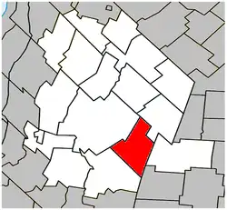 Location within Les Maskoutains RCM. | |
 Saint-Dominique Location in southern Quebec. | |
| Coordinates: 45°34′N 72°51′W / 45.567°N 72.850°W[1] | |
| Country | |
| Province | |
| Region | Montérégie |
| RCM | Les Maskoutains |
| Constituted | July 19, 1969 |
| Government | |
| • Mayor | Mario Beauchemin |
| • Federal riding | Saint-Hyacinthe—Bagot |
| • Prov. riding | Saint-Hyacinthe |
| Area | |
• Total | 71.10 km2 (27.45 sq mi) |
| • Land | 70.53 km2 (27.23 sq mi) |
| Population (2021)[4] | |
• Total | 2,741 |
| • Density | 38.9/km2 (101/sq mi) |
| • Pop 2016-2021 | |
| • Dwellings | 1,119 |
| Time zone | UTC−5 (EST) |
| • Summer (DST) | UTC−4 (EDT) |
| Postal code(s) | |
| Area codes | 450 and 579 |
| Highways | |
| Website | www.municipalite. saint-dominique.qc.ca |
Saint-Dominique (French pronunciation: [sɛ̃ dɔminik]) is a municipality in the Montérégie region of southwestern Quebec. The population as of the Canada 2021 Census was 2,741.
Demographics
Population
Canada census – Saint-Dominique community profile
| 2021 | 2016 | 2011 | |
|---|---|---|---|
| Population | 2,741 (+7.4% from 2016) | 2,553 (+9.7% from 2011) | 2,327 (+9.1% from 2006) |
| Land area | 70.53 km2 (27.23 sq mi) | 70.48 km2 (27.21 sq mi) | 69.08 km2 (26.67 sq mi) |
| Population density | 38.9/km2 (101/sq mi) | 36.2/km2 (94/sq mi) | 33.7/km2 (87/sq mi) |
| Median age | 37.2 (M: 37.6, F: 36.8) | 36.3 (M: 36, F: 36.8) | 37.1 (M: 37.5, F: 36.9) |
| Private dwellings | 1,090 (total) | 1,009 (total) | 943 (total) |
| Median household income | $84,000 | $68,864 | $61,438 |
|
|
|
Language
| Canada Census Mother Tongue - Saint-Dominique, Quebec[7] | ||||||||||||||||||
|---|---|---|---|---|---|---|---|---|---|---|---|---|---|---|---|---|---|---|
| Census | Total | French | English | French & English | Other | |||||||||||||
| Year | Responses | Count | Trend | Pop % | Count | Trend | Pop % | Count | Trend | Pop % | Count | Trend | Pop % | |||||
2021 | 2,740 | 2,645 | 96.5% | 20 | 0.7% | 10 | 0.4% | 55 | 2.0% | |||||||||
2016 | 2,555 | 2,485 | 97.3% | 20 | 0.8% | 5 | 0.2% | 40 | 1.6% | |||||||||
2011 | 2,325 | 2,280 | 98.1% | 20 | 0.9% | 10 | 0.4% | 15 | 0.7% | |||||||||
2006 | 2,115 | 2,075 | 98.1% | 20 | 1.0% | 10 | 0.5% | 10 | 0.5% | |||||||||
2001 | 2,220 | 2,195 | 98.9% | 25 | 1.1% | 0 | 0.0% | 0 | 0.0% | |||||||||
1996 | 2,245 | 2,215 | n/a | 98.7% | 10 | n/a | 0.5% | 0 | n/a | 0.0% | 20 | n/a | 0.9% | |||||
See also
References
- ^ "Banque de noms de lieux du Québec: Reference number 55927". toponymie.gouv.qc.ca (in French). Commission de toponymie du Québec.
- ^ a b Ministère des Affaires municipales, des Régions et de l'Occupation du territoire: Saint-Dominique
- ^ Parliament of Canada Federal Riding History: SAINT-HYACINTHE--BAGOT (Quebec)
- ^ a b c "2021 Community Profiles". 2021 Canadian census. Statistics Canada. February 4, 2022. Retrieved 2022-04-27.
- ^ "2016 Community Profiles". 2016 Canadian census. Statistics Canada. August 12, 2021. Retrieved 2024-01-29.
- ^ "2011 Community Profiles". 2011 Canadian census. Statistics Canada. March 21, 2019. Retrieved 2014-03-18.
- ^ a b Statistics Canada: 1996, 2001, 2006, 2011, 2016, 2021 census
Adjacent Municipal Subdivisions | |
|---|---|
| Cities | |
|---|---|
| Municipalities | |
| Parishes | |
| Villages | |
| |