Zlatá Olešnice (Trutnov District)
Zlatá Olešnice | |
|---|---|
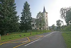 Church of Saint Catherine | |
_Flag.jpg) Flag _CoA.png) Coat of arms | |
 Zlatá Olešnice Location in the Czech Republic | |
| Coordinates: 50°37′4″N 15°56′42″E / 50.61778°N 15.94500°E | |
| Country | |
| Region | Hradec Králové |
| District | Trutnov |
| First mentioned | 1297 |
| Area | |
• Total | 9.43 km2 (3.64 sq mi) |
| Elevation | 473 m (1,552 ft) |
| Population (2025-01-01)[1] | |
• Total | 216 |
| • Density | 23/km2 (59/sq mi) |
| Time zone | UTC+1 (CET) |
| • Summer (DST) | UTC+2 (CEST) |
| Postal code | 541 01 |
| Website | www |
Zlatá Olešnice (German: Goldenöls) is a municipality and village in Trutnov District in the Hradec Králové Region of the Czech Republic. It has about 200 inhabitants.
Demographics
| Year | Pop. | ±% |
|---|---|---|
| 1869 | 843 | — |
| 1880 | 756 | −10.3% |
| 1890 | 652 | −13.8% |
| 1900 | 658 | +0.9% |
| 1910 | 683 | +3.8% |
| 1921 | 590 | −13.6% |
| 1930 | 596 | +1.0% |
| 1950 | 248 | −58.4% |
| 1961 | 267 | +7.7% |
| 1970 | 225 | −15.7% |
| 1980 | 184 | −18.2% |
| 1991 | 174 | −5.4% |
| 2001 | 158 | −9.2% |
| 2011 | 187 | +18.4% |
| 2021 | 213 | +13.9% |
| Source: Censuses[2][3] | ||
References
- ^ "Population of Municipalities – 1 January 2025". Czech Statistical Office. 2025-05-16.
- ^ "Historický lexikon obcí České republiky 1869–2011" (in Czech). Czech Statistical Office. 2015-12-21.
- ^ "Population Census 2021: Population by sex". Public Database. Czech Statistical Office. 2021-03-27.
External links
Wikimedia Commons has media related to Zlatá Olešnice (Trutnov District).