Allemans
Allemans | |
|---|---|
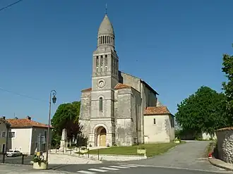 Church of Allemans | |
.svg.png) Coat of arms | |
Location of Allemans | |
 Allemans  Allemans | |
| Coordinates: 45°17′18″N 0°18′37″E / 45.2883°N 0.3103°E | |
| Country | France |
| Region | Nouvelle-Aquitaine |
| Department | Dordogne |
| Arrondissement | Périgueux |
| Canton | Ribérac |
| Government | |
| • Mayor (2020–2026) | Allain Tricoire[1] |
Area 1 | 18.75 km2 (7.24 sq mi) |
| Population (2022)[2] | 543 |
| • Density | 29/km2 (75/sq mi) |
| Time zone | UTC+01:00 (CET) |
| • Summer (DST) | UTC+02:00 (CEST) |
| INSEE/Postal code | 24007 /24600 |
| Elevation | 47–167 m (154–548 ft) (avg. 116 m or 381 ft) |
| 1 French Land Register data, which excludes lakes, ponds, glaciers > 1 km2 (0.386 sq mi or 247 acres) and river estuaries. | |
Allemans (French pronunciation: [almɑ̃]; Occitan: Alamans) is a commune in the Dordogne department in Nouvelle-Aquitaine in southwestern France.
Geography
The river Sauvanie forms the commune's northern border, then flows into the Lizonne, which forms the commune's north-western border; then the Lizonne flows into the Dronne, which forms the commune's south-western and southern borders.
Population
| Year | Pop. | ±% |
|---|---|---|
| 1962 | 485 | — |
| 1968 | 519 | +7.0% |
| 1975 | 511 | −1.5% |
| 1982 | 506 | −1.0% |
| 1990 | 489 | −3.4% |
| 1999 | 540 | +10.4% |
| 2008 | 566 | +4.8% |
See also
References
- ^ "Répertoire national des élus: les maires". data.gouv.fr, Plateforme ouverte des données publiques françaises (in French). 2 December 2020.
- ^ "Populations de référence 2022" (in French). The National Institute of Statistics and Economic Studies. 19 December 2024.
Wikimedia Commons has media related to Allemans.