List of Monuments of National Importance in Chennai circle
This is a list of Monuments of National Importance (ASI) as officially recognized by and available through the website of the Archaeological Survey of India for the Chennai Circle in the Indian state of Tamil Nadu. The Circle has a total of 250 Monuments and Sites of National Importance.[1][2]
List of monuments in the Chennai circle
| SL. No. | Description | Location | Address | District | Coordinates | Image |
|---|---|---|---|---|---|---|
| N-TN-C1 | "Arsenal" between Wellesley house and Clive’s House with shells and cannons piled together near the Gateway Block IV/1 to12 and 14 to18. | Chennai | Chennai | 13°04′41″N 80°17′06″E / 13.078°N 80.285°E | 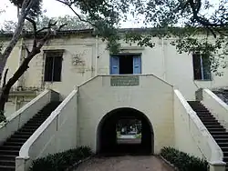 | |
| N-TN-C2 | Big Warehouse, south of the Church Library (in Block No.II/7). | Chennai | Chennai |  Upload Photo | ||
| N-TN-C3 | Chaplain’s house including portion which is the northern side of the Old Wall II/1. | Chennai | Chennai | 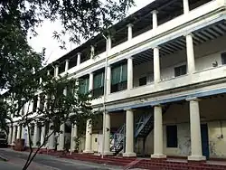 | ||
| N-TN-C4 | Clive’s House built in 1753. | Chennai | Chennai | 13°04′43″N 80°17′09″E / 13.0787°N 80.2859°E |  | |
| N-TN-C5 | Garrisons Engineer’s Depot, Block No.IV. | Chennai | Chennai | 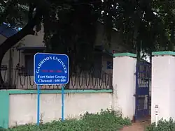 | ||
| N-TN-C6 | Guard Room Block No.V. | Chennai | Chennai |  | ||
| N-TN-C7 | It’s Ramparts, gates, bastions, Ravelins with vaulted chambers and water cisterns underneath, moat and defence walls all round with glacis to the extent of the existing barbed wire fence. | Chennai | Chennai |  | ||
| N-TN-C8 | King’s Barracks Block No.XXV. | Chennai | Chennai | 13°04′52″N 80°17′10″E / 13.081°N 80.2860796°E |  | |
| N-TN-C9 | Last house on the left of ‘Snobs Allay’ (oldest house in the Fort with carved staircase) – Block No. I/I. | Chennai | Chennai | 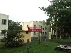 | ||
| N-TN-C10 | Nursing Sister’s House (Block I/3). | Chennai | Chennai |  | ||
| N-TN-C11 | Old British Infantry Officers Mess (Now Archaeological Dept. Office & Fort Museum) Block XXXVI-2. | Chennai | Chennai | 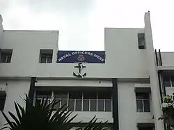
| ||
| N-TN-C12 | St. Mary’s Church with tablets laid on the ground and enclosed by a compound and a buried wall. | Chennai | Chennai | 13°04′43″N 80°17′12″E / 13.0787°N 80.2866°E | 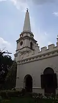 More images | |
| N-TN-C13 | Tomb of Elihu Yale and Joseph Hymmners in the compound of Law College, George town | Law College, Chennai | Chennai | 13°05′15″N 80°17′11″E / 13.08756111196583°N 80.2864141119754°E |  | |
| N-TN-C14 | Wellesley’s House (Built in 1798), Block No.IV/13. | Chennai | Chennai |  | ||
| N-TN-C15 | Old Town Wall | Tondiarpet | Chennai | 13°06′14″N 80°17′19″E / 13.103800591958935°N 80.28859561836501°E | Upload Photo | |
| N-TN-C19 | Megalithic cists and cairns (survey no.222) | Agaram | Chengalpattu | Upload Photo | ||
| N-TN-C20 | Megalithic cists and cairns (survey nos. 111 & 116) | Agaram | Chengalpattu | Upload Photo | ||
| N-TN-C21 | Urn burials | Alattur | Chengalpattu | Upload Photo | ||
| N-TN-C22 | Megalithic cists and cairns | Amur | Chengalpattu | Upload Photo | ||
| N-TN-C23 | Megalithic cists and cairns | Anur | Chengalpattu | Upload Photo | ||
| N-TN-C24 | Megalithic cists and cairns (Ownership: Private land) | Araiyapakkam | Chengalpattu | Upload Photo | ||
| N-TN-C25 | Megalithic cists and cairns | Atcharavakkam | Chengalpattu | Upload Photo | ||
| N-TN-C26 | Megalithic cists and cairns with stone circles | Ayyanjeri | Chengalpattu | Upload Photo | ||
| N-TN-C27 | Megalithic Cairns and Cists | Edakunram | Chengalpattu | Upload Photo | ||
| N-TN-C28 | Megalithic Cairns and Cists | Gudalur | Chengalpattu | Upload Photo | ||
| N-TN-C29 | Megalithic cists and cairns with stone circles | Guduvancheri (Vallamjeri) | Chengalpattu | Upload Photo | ||
| N-TN-C30 | Group of cairns | Kadapperi | Chengalpattu | Upload Photo | ||
| N-TN-C31 | Cairns in the forest reserve at the foot of the Perumbair hills. | Kadmalaiputhur | Chengalpattu | Upload Photo | ||
| N-TN-C32 | Chromlechs | Kadmalaiputhur | Chengalpattu | Upload Photo
| ||
| N-TN-C33 | Megalithic Cists and Cairns. | Kalanipakkam | Chengalpattu | Upload Photo | ||
| N-TN-C34 | Megalithic cists and cairns | Kalathur | Chengalpattu | Upload Photo | ||
| N-TN-C35 | Megalithic cists and cairns | Kalvay | Chengalpattu | Upload Photo | ||
| N-TN-C36 | Cists and cairns | Kanakapattu | Chengalpattu | Upload Photo | ||
| N-TN-C37 | Megalithic cists and cairns with Bounding stone circles. | Kandalur | Chengalpattu | Upload Photo | ||
| N-TN-C38 | Megalithic cists and cairns with stone circles. | Kattuputhur | Chengalpattu | Upload Photo | ||
| N-TN-C39 | Megalithic cairns and cists with stone circles. | Kilampakkam | Chengalpattu | Upload Photo | ||
| N-TN-C40 | Megalithic cists and cairns | Kottamedu | Chengalpattu | Upload Photo | ||
| N-TN-C41 | Megalithic cists and cairns | Kumili | Chengalpattu | Upload Photo | ||
| N-TN-C42 | Megalithic cairns and cist with bounding circles. | Kunnavakkam | Chengalpattu | Upload Photo | ||
| N-TN-C43 | Megalithic cists and cairns | Kuravanmedu | Chengalpattu | Upload Photo | ||
| N-TN-C44 | a) Dhenupurisvara Temple, b)Graden attached to above temple | Madambakkam | Chengalpattu | 12°53′55″N 80°09′37″E / 12.898649104930888°N 80.16019606934056°E |  More images | |
| N-TN-C45 | Megalithic cairns and cists with stone circles. | Madayathur | Chengalpattu | Upload Photo | ||
| N-TN-C46 | Megalithic cists and cairns | Mailai | Chengalpattu | Upload Photo | ||
| N-TN-C47 | Megalithic cists and cairns | Malaivaiyavur | Chengalpattu | Upload Photo | ||
| N-TN-C48 | Aleva shore Temple | Mamallapuram | Chengalpattu | 12°36′59″N 80°11′58″E / 12.616422241103452°N 80.19933231801579°E | 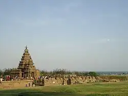 More images | |
| N-TN-C49 | Arjuna’s Penance | Mamallapuram | Chengalpattu | 12°37′04″N 80°11′33″E / 12.6178°N 80.1926°E |  More images | |
| N-TN-C50 | Arjuna’s Ratha | Mamallapuram | Chengalpattu | 12°36′32″N 80°11′23″E / 12.6088986°N 80.1896515°E | 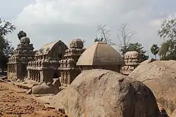 | |
| N-TN-C51 | Bhima’s Ratha | Mamallapuram | Chengalpattu | 12°36′32″N 80°11′22″E / 12.6087808°N 80.1895684°E | .JPG) | |
| N-TN-C52 | Dharmaraja’s Ratha | Mamallapuram | Chengalpattu | 12°36′31″N 80°11′22″E / 12.6086342°N 80.1894638°E |  | |
| N-TN-C53 | Dharmaraja Rock Cut Throne | Mamallapuram | Chengalpattu |  | ||
| N-TN-C54 | Dolostva Mandapa | Mamallapuram | Chengalpattu |  | ||
| N-TN-C55 | Draupadi’s Bath | Mamallapuram | Chengalpattu |  | ||
| N-TN-C56 | Draupathi Ratha | Mamallapuram | Chengalpattu | 12°36′32″N 80°11′23″E / 12.6089509°N 80.1897159°E |  | |
| N-TN-C57 | Eight Stone Images On A Masonry Platform Known As The Seven Pidaris | Mamallapuram | Chengalpattu | .jpg) | ||
| N-TN-C58 | Huge Stone Figures Of The Lion, Elephant, And A Bull | Mamallapuram | Chengalpattu | 12°36′32″N 80°11′23″E / 12.6089°N 80.1895872°E | _(37427256786).jpg) | |
| N-TN-C59 | Olakkanesvara Temple | Mamallapuram | Chengalpattu | 12°37′00″N 80°11′30″E / 12.6167°N 80.1917°E |  More images | |
| N-TN-C60 | Kotikal Mandapa | Mamallapuram | Chengalpattu | 12°37′00″N 80°11′30″E / 12.6166°N 80.1917°E |  More images | |
| N-TN-C61 | Krishna Mandapam | Mamallapuram | Chengalpattu | 12°37′00″N 80°11′30″E / 12.6166°N 80.1917°E |  | |
| N-TN-C62 | Krishna’s Butter Ball | Mamallapuram | Chengalpattu | 12°37′09″N 80°11′32″E / 12.6191°N 80.1923°E |  | |
| N-TN-C63 | Large unfinished rock sculpture similar to Arjuna’s Penance near the light-house. | Mamallapuram | Chengalpattu |  | ||
| N-TN-C64 | Mahishamardini Rock Cut Mandapa | Mamallapuram | Chengalpattu | 12°37′00″N 80°11′30″E / 12.6167°N 80.1917°E |  | |
| N-TN-C65 | Mahishasura Rock Standing In The Sea To The North Of Shore Temple | Mamallapuram | Chengalpattu | 12°37′02″N 80°11′57″E / 12.617347442080074°N 80.19913942906526°E | Upload Photo | |
| N-TN-C66 | Mukundanayanar Temple | Mamallapuram | Chengalpattu | 12°37′38″N 80°11′42″E / 12.627173756149988°N 80.19489005977557°E |  | |
| N-TN-C67 | Rock Cut Sculpture, Representing The Group Of Elephants, Monkey And Peacock | Mamallapuram | Chengalpattu |  | ||
| N-TN-C68 | Rock Cut Ganesha Temple | Mamallapuram | Chengalpattu | 12°37′06″N 80°11′33″E / 12.61842°N 80.1925°E |  | |
| N-TN-C69 | Rock Cut Varaha Temple Containing Varaha And Vamana Incarnation Of Vishnu | Mamallapuram | Chengalpattu |  | ||
| N-TN-C70 | Rayagopuram(Unfinished) | Mamallapuram | Chengalpattu | _at_Mamallpuram%E2%80%9D.JPG) | ||
| N-TN-C71 | Sahadeva’s Ratha | Mamallapuram | Chengalpattu |  | ||
| N-TN-C72 | Small Monbolithic Temple Known As Valayankuttai Ratha | Mamallapuram | Chengalpattu | Upload Photo | ||
| N-TN-C73 | Stone Sculpture Representing The Group Of Monkeys | Mamallapuram | Chengalpattu |  | ||
| N-TN-C74 | Triple-celled rock-cut shrine with Gopi’s Churn in front of it | Mamallapuram | Chengalpattu |  | ||
| N-TN-C75 | Two Rock Cut Temples At North East Corner Of The Koneri Pallam Tank | Mamallapuram | Chengalpattu |  | ||
| N-TN-C76 | Two Small-Carved Rocks To The South Of The Shore Temple. | Mamallapuram | Chengalpattu | Upload Photo | ||
| N-TN-C77 | Two Small Monolithic Temples Known As Pidari Amman Ratha | Mamallapuram | Chengalpattu |  | ||
| N-TN-C78 | Two Unfinished Excavations Near The Light House | Mamallapuram | Chengalpattu |  | ||
| N-TN-C79 | Unfinished Excavation close to the Triple Celled Rock-cut Shrine with Gopi’s churn in front of it. | Mamallapuram | Chengalpattu | Upload Photo | ||
| N-TN-C80 | Unfinished Excavations South Of Draupadi Rath | Mamallapuram | Chengalpattu | Upload Photo | ||
| N-TN-C81 | Unfinished Ratha And Stone Couch | Mamallapuram | Chengalpattu | Upload Photo | ||
| N-TN-C82 | Unfinished Rock Cut Cave Temple North Of Krishna Mandapa | Mamallapuram | Chengalpattu |  | ||
| N-TN-C83 | Megalithic cists and cairns | Mampattu | Chengalpattu | Upload Photo | ||
| N-TN-C84 | Megalithic cists and cairns | Manamai | Chengalpattu | Upload Photo | ||
| N-TN-C85 | Megalithic cists and cairns | Melkottaiyur | Chengalpattu | Upload Photo | ||
| N-TN-C86 | Megalithic cists and cairns | Musaivakkam | Chengalpattu | Upload Photo | ||
| N-TN-C87 | Megalithic cists and cairns with stone circles | Naduvakkarai | Chengalpattu | Upload Photo | ||
| N-TN-C88 | Megalithic cists and cairns | Nallikuppam | Chengalpattu | Upload Photo | ||
| N-TN-C89 | Megalithic cists and cairns with stone circles | Nandivaram | Chengalpattu | Upload Photo | ||
| N-TN-C90 | Group of cairns (Within the Reserved Forest) | Nanmangalam | Chengalpattu | Upload Photo | ||
| N-TN-C91 | Megalithic cists and cairns | Nattam | Chengalpattu | Upload Photo | ||
| N-TN-C92 | Megalithic cists and cairns | Nedungunram | Chengalpattu | Upload Photo
| ||
| N-TN-C93 | Megalithic cists and cairns with stone circles | Olalur | Chengalpattu | Upload Photo | ||
| N-TN-C94 | Megalithic cists and cairns | Ottivakkam | Chengalpattu | Upload Photo | ||
| N-TN-C95 | Munkudmisvara Temple | P.V.Kalathur | Chengalpattu | 12°37′03″N 79°58′50″E / 12.617626657924253°N 79.98058120593076°E | Upload Photo | |
| N-TN-C96 | Megalithic cists and cairns | Padur | Chengalpattu | Upload Photo | ||
| N-TN-C97 | Megalithic cairns and cists in showing clear structural Postures. | Pallavaram | Chengalpattu | Upload Photo | ||
| N-TN-C98 | Megalithic cists and cairns with stone circles. | Palliyagaram | Chengalpattu | Upload Photo | ||
| N-TN-C99 | Megalithic cists and cairns | Paranur | Chengalpattu | Upload Photo | ||
| N-TN-C100 | Megalithic cists and cairns | Perumbakkam | Chengalpattu | Upload Photo | ||
| N-TN-C101 | Megalithic cists with stone circles circumscribing. (Survey No.367, 454 and 365-A) (367&454 - 206.77 acres Of this, 57.94 acres is private property with several buildings constructed and under construction)(GST Road and Railway lines from Chennai to southern districts pass through the site. Large number of houses are there.Please see The Hindu Business Online 24.11.2005) | Perungalathur | Chengalpattu | Upload Photo | ||
| N-TN-C102 | Megalithic cists and cairns with stone circles | Ponmar | Chengalpattu | Upload Photo | ||
| N-TN-C103 | Megalithic cists and cairns | Porundavakkam | Chengalpattu | Upload Photo | ||
| N-TN-C104 | Megalithic cists and cairns | Pudupakkam | Chengalpattu | Upload Photo | ||
| N-TN-C105 | Megalithic Cists and Cairns Bounded With Stone Circles | Pulippakkam | Chengalpattu | Upload Photo | ||
| N-TN-C106 | Megalithic Cists and Cairns | Pundi | Chengalpattu | Upload Photo | ||
| N-TN-C107 | Megalithic Cists Circumscribed by Stone Circles | Rajakulipettai | Chengalpattu | Upload Photo | ||
| N-TN-C108 | Megalithic Cists and Cairns with Stone Circles | Rayalpattu | Chengalpattu | Upload Photo | ||
| N-TN-C109 | Ruined Dutch Fort And Cemetery | Sadras | Chengalpattu | 12°31′33″N 80°09′49″E / 12.525730477712592°N 80.1636360993776°E |  More images | |
| N-TN-C110 | Rock Cut Shiva Temple With Three Lingas | Salavankuppam | Chengalpattu | 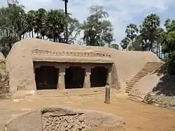 More images | ||
| N-TN-C111 | Tiger-Headed Rock Cut Temple | Salvankuppam | Chengalpattu | 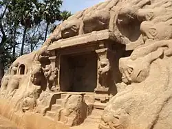 More images | ||
| N-TN-C112 | Two inscribed rocks, one having six and the other fifty lines of ancient Tamil inscriptions with remains of other ancient buildings around them | Salavankuppam | Chengalpattu | Upload Photo | ||
| N-TN-C113 | Megalithic Cists and Cairns | Sanur | Chengalpattu | Upload Photo | ||
| N-TN-C114 | Megalithic Cists and Cairns in Virgin State. | Sastirampakkam | Chengalpattu | Upload Photo | ||
| N-TN-C115 | Group of Cairns and Cists (Within the Reserved Forest) | Sembakkam | Chengalpattu | Upload Photo | ||
| N-TN-C116 | Megalithic Cists and Cairns (Withine the Reserved Forest) | Sembakkam | Chengalpattu | Upload Photo | ||
| N-TN-C117 | Megalithic Cists and Cairns | Sengunram | Chengalpattu | Upload Photo | ||
| N-TN-C118 | Megalithic Cists and Cairns intact with Stone Circles. | Settipuniyam | Chengalpattu | Upload Photo | ||
| N-TN-C119 | Megalithic Cists and Cairns | Sirudavur | Chengalpattu | Upload Photo | ||
| N-TN-C120 | Megalithic Cists and Cairns | Sirukunram | Chengalpattu | Upload Photo | ||
| N-TN-C121 | Megalithic Cists and Cairns | Sittalapakkam | Chengalpattu | Upload Photo | ||
| N-TN-C122 | Urn Burial and Megalithic Site | St. Thomas Mount | Chengalpattu | Upload Photo | ||
| N-TN-C123 | Megalithic Cists and Cairns | Tandalam | Chengalpattu | Upload Photo | ||
| N-TN-C124 | Orukkal Mandapam | Tirukallikunram | Chengalpattu | 12°36′35″N 80°03′34″E / 12.609642961301152°N 80.0594235292835°E | Upload Photo | |
| N-TN-C125 | Group Of Cairns | Tiruneermalai | Chengalpattu | Upload Photo | ||
| N-TN-C126 | Megalithic Cist | Tiruneermalai | Chengalpattu | Upload Photo | ||
| N-TN-C127 | Vast area of megalithic cists and cairns covering the entire hill with the temple of Kailasanatha. | Tirupporur | Chengalpattu | 12°43′36″N 80°11′09″E / 12.726729157092585°N 80.18594606421127°E | Upload Photo | |
| N-TN-C128 | Sarcophagi and urns spread over a wide area;traces of Megalithic cists and circles. | Tirusulam | Chengalpattu | Upload Photo | ||
| N-TN-C129 | Nityakalyanasvami Temple | Tiruvidanthai | Chengalpattu | 12°45′48″N 80°14′32″E / 12.763326067351608°N 80.24212157159677°E |  More images | |
| N-TN-C130 | Megalithic Grave Yard | Tiryvadisulam | Chengalpattu | Upload Photo | ||
| N-TN-C131 | Megalithic Cists and Cairns | Unamanjeri | Chengalpattu | Upload Photo | ||
| N-TN-C132 | Megalithic Cists and Cairns | Vaiyavur | Chengalpattu | Upload Photo | ||
| N-TN-C133 | Megalithic Cists | Vandalur | Chengalpattu | Upload Photo | ||
| N-TN-C134 | Tirupulisvara Temple | Vayalur | Chengalpattu | 12°29′19″N 80°07′49″E / 12.48857451580434°N 80.13028602047818°E | Upload Photo | |
| N-TN-C135 | Megalithic Cists and Cairns With Stone Circles | Vedanarayana Puram | Chengalpattu | Upload Photo | ||
| N-TN-C136 | Megalithic Cists and Cairns | Vembedu | Chengalpattu | Upload Photo | ||
| N-TN-C137 | Megalithic Cists and Cairns | Vengur | Chengalpattu | Upload Photo | ||
| N-TN-C138 | Megalithic Cists and Cairns With Stone Circles | Venkitapuram | Chengalpattu | Upload Photo | ||
| N-TN-C139 | Megalithic cists and cairns with stone circles | Venpakkam Village No.69 | Chengalpattu | Upload Photo | ||
| N-TN-C140 | Megalithic cists and cairns with stone circles | Venpakkam Village No.273 | Chengalpattu | Upload Photo | ||
| N-TN-C141 | Megalithic Cists and Cairns | Virapuram | Chengalpattu | Upload Photo | ||
| N-TN-C16 | Nithisvarasvami Temple | Srimushnam | Cuddalore | 11°24′07″N 79°24′25″E / 11.40193598543643°N 79.40704578016194°E | .jpg) More images | |
| N-TN-C17 | Chennaraya Perumal Temple Together With Adjacent Lands | Adiyamankottai | Dharmapuri | 12°04′29″N 78°07′08″E / 12.0747°N 78.1189°E |  More images | |
| N-TN-C18 | Jain Temple | Mettupudur | Erode | 11°14′58″N 77°30′11″E / 11.249411769980533°N 77.50307480901299°E | .jpg) More images | |
| N-TN-C246 | Apathsahayeswra Temple and gateway with Horses. | Sendamangalam | kallakurichi | 11°44′46″N 79°22′39″E / 11.746045801797916°N 79.37757262582141°E |  | |
| N-TN-C142 | Iravatanesvara Temple | Big Kanchipuram | Kanchipuram | 12°50′20″N 79°42′07″E / 12.838957187800572°N 79.701850915948°E | Upload Photo | |
| N-TN-C143 | Jvarahareswara Swamiar Temple | Big Kanchipuram | Kanchipuram | 12°50′32″N 79°41′55″E / 12.842169635593262°N 79.69870040071899°E |  | |
| N-TN-C144 | Megalithic Cists and Cairns with bounding stone-circles | Echchur | Kanchipuram | Upload Photo
| ||
| N-TN-C145 | Megalithic Cairns and Cists | Eluchur | Kanchipuram | Upload Photo | ||
| N-TN-C146 | Megalithic Cairns and Cists | Erumaiyur | Kanchipuram | Upload Photo
| ||
| N-TN-C147 | Megalithic cists and cairns with stone circles | Guduperum Bedu | Kanchipuram | Upload Photo
| ||
| N-TN-C148 | Piravatanesvara Temple together with the whole of the land in town survey No. M 128I Ward No. IV, Block No. 17 | Kanchipuram | Kanchipuram | 12°50′43″N 79°42′22″E / 12.845405540435527°N 79.70621316513255°E |  | |
| N-TN-C149 | Sri Mathangeswarar Swamiar Temple | Kanchipuram | Kanchipuram | 12°50′08″N 79°42′30″E / 12.83565663835725°N 79.70828094491273°E | 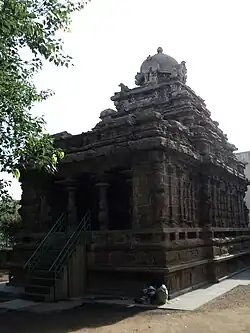 More images | |
| N-TN-C150 | Sri Muktesvara Swami Temple | Kanchipuram | Kanchipuram | 12°50′20″N 79°42′28″E / 12.838845395126635°N 79.70775159029763°E |  More images | |
| N-TN-C151 | Vaikuntaperumal koil temple | Kanchipuram | Kanchipuram | 12°50′14″N 79°42′36″E / 12.837113356063782°N 79.70988406123668°E | 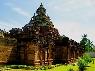 More images
| |
| N-TN-C152 | Megalithic cairns and cists | Karanaithangal Porinjam Bakkam | Kanchipuram | Upload Photo
| ||
| N-TN-C153 | Megalithic cists and cairns with stone circles on the hill. | Kunnattur | Kanchipuram | Upload Photo
| ||
| N-TN-C154 | Large Siva Temple (Aabathsahayeswarar Temple) | Tenneri | Kanchipuram | 12°51′09″N 79°51′12″E / 12.852630979173231°N 79.85343419698991°E | Upload Photo
| |
| N-TN-C155 | Megalithic cists and cairns | Maganiyam | Kanchipuram | Upload Photo
| ||
| N-TN-C156 | Megalithic Cists and Cairns with bounding stone-circles. | Malaipattu | Kanchipuram | Upload Photo
| ||
| N-TN-C157 | The Old Temple with apsidal Gopuram. (Dharmeswarar Temple) | Manimagalam | Kanchipuram | 12°54′56″N 80°02′36″E / 12.915486906487775°N 80.04334530766079°E |  More images
| |
| N-TN-C158 | Megalithic cists and cairns | Nandambakkam | Kanchipuram | Upload Photo
| ||
| N-TN-C159 | Megalithic cists and cairns | Ottiyambakkam | Kanchipuram | Upload Photo
| ||
| N-TN-C160 | Megalithic cists and cairns | Palayasivaram | Kanchipuram | Upload Photo
| ||
| N-TN-C161 | Megalithic cists and cairns | Perunagar | Kanchipuram | Upload Photo
| ||
| N-TN-C162 | Kailasanatha Temple | Salabogam | Kanchipuram | 12°50′32″N 79°41′23″E / 12.842239390764247°N 79.68972841431587°E |  More images
| |
| N-TN-C163 | Megalithic Cists and Cairns | Settupattu | Kanchipuram | Upload Photo | ||
| N-TN-C164 | Megalithic Cairns With Stone Circles and Sarvophagi | Sikkarayapuram | Kanchipuram | 13°00′50″N 80°06′09″E / 13.013970099534228°N 80.10241557582873°E | Upload Photo
| |
| N-TN-C165 | Megalithic Cists and Cairns | Sirukalattur | Kanchipuram | Upload Photo
| ||
| N-TN-C166 | Megalithic Cists and Cairns | Tattanur | Kanchipuram | Upload Photo | ||
| N-TN-C167 | Lesser Siva Temple (Kanthalingeswara Temple) | Tenneri (Madavilaam) | Kanchipuram | 12°50′59″N 79°51′31″E / 12.84982648927119°N 79.8587302889852°E | Upload Photo
| |
| N-TN-C168 | Venkatesaperumal Temple | Tirumukkudal | Kanchipuram | 12°45′46″N 79°51′38″E / 12.762818673535001°N 79.86055420921167°E | Upload Photo
| |
| N-TN-C169 | Vaikunta Perumal temple together with adjacent land | Uttiramerur | Kanchipuram | 12°36′55″N 79°45′30″E / 12.61525520998356°N 79.75837784031323°E |  More images | |
| N-TN-C170 | A Dolmen Intact | Uttiramerur | Kanchipuram | Upload Photo | ||
| N-TN-C171 | Megalithic Cists and Cairns | Vadakkuppattu | Kanchipuram | Upload Photo | ||
| N-TN-C172 | Megalithic Cists and Cairns | Vadamangalam | Kanchipuram | Upload Photo
| ||
| N-TN-C173 | Megalithic Cists and Cairns | Venpakkam Village No.186 | Kanchipuram | Upload Photo
| ||
| N-TN-C175 | Hill Fort | Krishnagiri | Krishnagiri | 12°32′19″N 78°12′49″E / 12.53855412807435°N 78.21362485065005°E |  More images | |
| N-TN-C176 | Hill Fort | Rayakkottai | Krishnagiri | 12°31′17″N 78°02′13″E / 12.52140173818546°N 78.03701430975622°E |  More images | |
| N-TN-C177 | Hill Fort | Namakkal | Namakkal | 11°13′20″N 78°09′55″E / 11.222106777306733°N 78.16532632379538°E |  More images | |
| N-TN-C178 | The Temples of Sri Ranganatha Swamy And Sri Narasimha Swamy Temple on either side of the hill. | Namakkal | Namakkal | 11°13′21″N 78°09′53″E / 11.222365883932165°N 78.16472593611763°E | 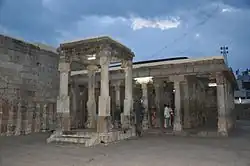 More images | |
| N-TN-C179 | Megalithic Cists and Cairns | Karai | Perambalur | Upload Photo | ||
| N-TN-C180 | Ranjankudi Fort | Ranjankudi | Perambalur | 11°20′47″N 78°56′21″E / 11.346488575729467°N 78.93924845384281°E |  More images | |
| N-TN-C181 | Siva Temple (Vaaleeswarar Temple) | Valikantapuram | Perumbalur | 11°18′55″N 78°54′56″E / 11.315281103709555°N 78.91541932560376°E | Upload Photo | |
| N-TN-C182 | Shamshkhan’s Mosque | Vallapuram | Perambalur | 11°19′07″N 78°54′49″E / 11.318681104825735°N 78.91365030480125°E | 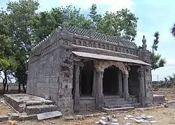 More images | |
| N-TN-C213 | Delhi Gate | Arcot | Ranipet | 12°54′27″N 79°20′16″E / 12.907363579623564°N 79.33789430526853°E |  More images | |
| N-TN-C214 | Masjid and 2 ponds in the west of the citadel. | Arcot | Ranipet | 12°54′03″N 79°20′07″E / 12.900841422761825°N 79.33519245922602°E |  | |
| N-TN-C215 | Adjoining Building To The Masjid And Two Ponds. | Arcot | Ranipet | 12°54′03″N 79°20′06″E / 12.900805472163444°N 79.3348912189405°E | Upload Photo | |
| N-TN-C216 | The Cannon | Arcot | Ranipet | 12°54′05″N 79°20′07″E / 12.90142572534861°N 79.33514480714709°E |  More images | |
| N-TN-C218 | Monolithic Rock Cut Temple | Mahendravadi | Ranipet | 12°59′22″N 79°32′30″E / 12.989532269611537°N 79.54172237341595°E |  More images | |
| N-TN-C221 | North Eastern Corner Of The Outer Rampart Of The Old Fort At Arcot | Muppaduvetti | Ranipet | 12°53′36″N 79°20′24″E / 12.893210978717661°N 79.34013650328521°E | Upload Photo
| |
| N-TN-C222 | Rock Inscription On The Right Flank Of The Sholinghur Tank | Sholinghur | Ranipet | 13°05′19″N 79°25′06″E / 13.088516440488464°N 79.41836507006397°E |  More images
| |
| N-TN-C223 | Konar Temple | Tirumalpur | Ranipet | 12°56′35″N 79°38′59″E / 12.943137121760968°N 79.64976448050321°E |  More images | |
| N-TN-C229 | Rock, Sculptures & Caves | Vilapakkam | Ranipet | 12°51′56″N 79°16′47″E / 12.865656891269918°N 79.27971275658791°E |  More images | |
| N-TN-C183 | Remains Of Fort With Building Thereon: Fort of Attur | Attur | Salem | 11°36′09″N 78°35′55″E / 11.602455228139295°N 78.5986837970859°E | 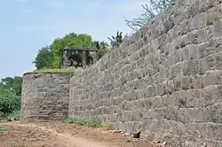 More images | |
| N-TN-C184 | Fort And Temple (Varadaraja Perumal Temple) On The Hill | Chinna Kavandanur | Salem | 11°28′46″N 77°51′53″E / 11.479427380340114°N 77.86476253001891°E |  More images | |
| N-TN-C185 | Urn burials | Amirtha Mangalam | Tiruvallur | Upload Photo | ||
| N-TN-C186 | A Virigin Ground Containing many Burrows. | Attanthangal | Tiruvallur | Upload Photo | ||
| N-TN-C187 | Megalithic Cists | Chedalpakkam | Tiruvallur | Upload Photo | ||
| N-TN-C188 | Megalithic cairns and Barrows | Neyveli | Tiruvallur | Upload Photo | ||
| N-TN-C189 | Urn Burials | Palavakkam | Tiruvallur | Upload Photo | ||
| N-TN-C190 | Megalithic Cists and Cairns | Pammadukulam | Tiruvallur | Upload Photo | ||
| N-TN-C191 | Megalithic cists and cairns with bounding stone circles | Panchali | Tiruvallur | Upload Photo | ||
| N-TN-C192 | Megalithic Cists and Cairns | Pondavakkam | Tiruvallur | Upload Photo | ||
| N-TN-C193 | Megalithic Cists and Cairns | Pottur | Tiruvallur | Upload Photo | ||
| N-TN-C194 | The Prehistoric settlement site coeval with the Megalithic period. | Pulal | Tiruvallur | Upload Photo | ||
| N-TN-195 | Dutch Cemetery | Pulicat | Tiruvallur | 13°25′08″N 80°18′55″E / 13.418751097478712°N 80.31516522515903°E |  More images | |
| N-TN-C196 | Cairn Site | Sengarai | Tiruvallur | Upload Photo | ||
| N-TN-C197 | Megalithic cairns with bounding stone circles | Siruvadu | Tiruvallur | Upload Photo | ||
| N-TN-C198 | Megalithic cairns with bounding stone circles | Tadipadi | Tiruvallur | Upload Photo | ||
| N-TN-C199 | Megalithic cairns with bounding stone circles. | Vanmalli | Tiruvallur | Upload Photo | ||
| N-TN-C200 | Svayambunathar Temple | Kilputhur | Tiruvannamalai | 12°26′49″N 79°31′12″E / 12.446989830320888°N 79.5199595792591°E | Upload Photo | |
| N-TN-C201 | Rock-Cut Shrine | Kuranganilmuttam | Tiruvannamalai | 12°46′03″N 79°41′33″E / 12.767634210145129°N 79.69258824572194°E |  More images | |
| N-TN-C202 | Rock Cut Caves, Sculptures And Inscriptions. | Mamandur | Tiruvannamalai | 12°44′30″N 79°39′57″E / 12.741692194668948°N 79.6658969374732°E |  More images | |
| N-TN-C203 | Site containing megalithic burials including the monolithic anthromorphic figure erected at the site. | Mottur | Tiruvannamalai | Upload Photo | ||
| N-TN-C204 | Rock Cut Caves | Narasamangalam | Tiruvannamalai |  More images | ||
| N-TN-C205 | Chandramoulisvarar temple together with adjacent land. | Nattery | Tiruvannamalai | 12°49′51″N 79°31′13″E / 12.830838071458372°N 79.52037309206085°E | Upload Photo | |
| N-TN-C206 | Megalithic Cists and Cairns | Nedungal | Tiruvannamalai | Upload Photo | ||
| N-TN-C207 | Rock Cut Temple And Sculptures | Siyamangalam | Tiruvannamalai | 12°25′53″N 79°27′57″E / 12.431374224649614°N 79.46577719447598°E | 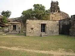 More images | |
| N-TN-C208 | Megalithic Cists | Tellur | Tiruvannamalai | Upload Photo | ||
| N-TN-C209 | Megalithic Cists and Cairns | Tetturai | Tiruvannamalai | Upload Photo | ||
| N-TN-C210 | Jain Temple | Tirumalai | Tiruvannamalai | 12°33′26″N 79°12′22″E / 12.557221125980394°N 79.20611987485023°E |  More images | |
| N-TN-C211 | Two natural caverns known as Virupakshi Cuha & Skandashram with the passage leading to Skandasramam from Ramanasramam. | Tiruvannamali | Tiruvannamalai | 12°14′01″N 79°03′43″E / 12.233486775976548°N 79.0620830115434°E |  More images | |
| N-TN-C212 | Megalithic Cists and Cairns | Venkunnam | Tiruvannamalai | Upload Photo
| ||
| N-TN-C217 | Ranganatha Temple (Aranganathar Temple) along with adjoining area comprised in a portion. | Erukkampattu | Vellore | 13°05′24″N 79°15′45″E / 13.090004891477712°N 79.26260888189478°E |  More images
| |
| N-TN-C219 | Choleswara Temple | Melpadi | Vellore | 13°03′50″N 79°17′04″E / 13.063956173448046°N 79.28448874560891°E |  More images | |
| N-TN-C220 | Somanatha Temple | Melpadi | Vellore | 13°03′54″N 79°17′03″E / 13.064911339875962°N 79.28416252900782°E |  More images
| |
| N-TN-C224 | Jain Sculpture And Inscription on the hill | Vallimalai | Vellore | 13°04′30″N 79°15′45″E / 13.075010169636338°N 79.26255061633209°E |  More images | |
| N-TN-C225 | Subramanya Temple | Vallimalai | Vellore | 13°04′26″N 79°15′35″E / 13.073859603941782°N 79.25977343184728°E | 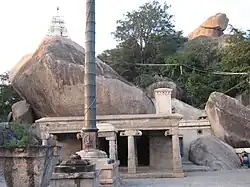 More images | |
| N-TN-C226 | Fort | Vellore | Vellore | 12°55′16″N 79°07′50″E / 12.92121905712791°N 79.13049255007715°E |  More images | |
| N-TN-C227 | Jalkanteswara Temple | Vellore | Vellore | 12°55′20″N 79°07′45″E / 12.9223577988772°N 79.12928813451819°E |  More images | |
| N-TN-C228 | Old Mosque In The Fort | Vellore | Vellore | 12°55′09″N 79°07′45″E / 12.919178981673015°N 79.12922272617557°E | Upload Photo
| |
| N-TN-C230 | Brahmapurisvara Temple | Brahmadesam | Viluppuram | 12°07′09″N 79°28′42″E / 12.119036064465252°N 79.47838381594192°E |  More images | |
| N-TN-C231 | Sri Pathaleswara Temple | Brahmadesam | Viluppuram | 12°07′05″N 79°28′54″E / 12.11798526485155°N 79.48175927729389°E |  More images | |
| N-TN-C232 | Rock Cut Pallava Temple | Dalavanur | Viluppuram | 12°10′00″N 79°28′07″E / 12.1665533433477°N 79.46871717176394°E |  More images | |
| N-TN-C233 | Sri Alagiya Narasimha Perumal Temple | Ennayiram | Viluppuram | 12°07′28″N 79°29′32″E / 12.124564950794472°N 79.49224022278798°E |  More images | |
| N-TN-C234 | Fortress comprising hill fort on the Rajagiri, the inner and lower fort, and lines of fortifications connecting the Rajagiri, Krishnagiri and Chakkilidurg (Orme’s St. George’s mountain) hills. | Gingee | Viluppuram | 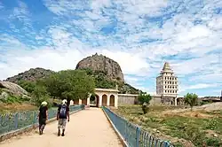 More images | ||
| N-TN-C235 | In the minor and lower forts- (a) (i) Inner fort, Venugopala temple called ‘BajanaiKudam’ with large polished slab and fine carved figures in three panels, a granary, a gymnasium, Kalyana Mahal (ii) Stables and barracks, the remains of Mahabut Khan’s mosque (iii) Anaikulam tank (b) Lower fort, Chakkarikulam and Chettikulam ponds, a dais with two idols representing Kamalakanni Ammal and with two symbols of serpent god, the masonry platform of Desings funeral pyre and his girl-wife’s sati, idol ofHanuman. | Gingee | Viluppuram |  | ||
| N-TN-C236 | Old Jail near the Pondicherry gate and two Persian inscriptions on the outer face of the last two bastions in the south of the eastern wall of the inner fort. | Gingee | Viluppuram | Upload Photo | ||
| N-TN-C237 | On the Krishnagiri-Two granaries, well for storing ghee,well for storing oil, two temples and an audience chamber. | Gingee | Viluppuram | 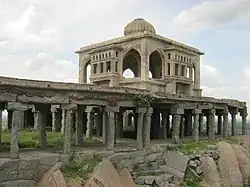 | ||
| N-TN-C238 | On the Rajagiri - Two granaries, a magazine,flagstaff, Ranganatha temple, Kamalakanniamman temple and the sacrificial slab in front of it, a big cannon, a treasury and an audience hall. | Gingee | Viluppuram |  | ||
| N-TN-C239 | Saad-at-alla Khan’s mosque with Persian inscriptions, inscriptions in Persian on Pondicherry gate (A.D. 1713). | Gingee | Viluppuram | Upload Photo | ||
| N-TN-C240 | Venkararamana Temple With Inscription In Tamil-Prisoner's Well | Gingee | Viluppuram |  | ||
| N-TN-C241 | Urn Burial Site | Kadagambattu | Viluppuram | Upload Photo | ||
| N-TN-C242 | Pallava Rock-Cut Shrine | Kilmavilangai | Viluppuram | 12°19′34″N 79°36′23″E / 12.326191079836603°N 79.6065081908431°E |  More images | |
| N-TN-C243 | Rock-cut Pallava Temple | Mandagapattu | Viluppuram | 12°06′28″N 79°27′23″E / 12.107653194940056°N 79.45648036285725°E |  More images | |
| N-TN-C244 | Outside The Fort-Pattabhirama Temple And 12 Pillared Mandapa | Narasingarayanan pettai | Viluppuram | 12°14′05″N 79°24′13″E / 12.234613324262256°N 79.40371631844121°E |  More images | |
| N-TN-C245 | Talagirisvara temple and a cave containing an image of Durga and Pallava inscription together with adjacent land | Panamalai | Viluppuram | 12°06′15″N 79°22′43″E / 12.104197650129729°N 79.37871773738998°E |  More images
| |
| N-TN-C247 | Megalithic Cairns and Stone Circles | Sengamedu | Viluppuram | Upload Photo | ||
| N-TN-C248 | 24 Jain Figure In Two Rows, A Standing Nude Figure, Two Fragments Of A Sitting Figure And Two Inscritpions On Tirunathankunru. | Sirukadambur | Viluppuram | 12°16′23″N 79°24′25″E / 12.27295662953427°N 79.40699819433523°E | Upload Photo | |
| N-TN-C249 | Vinnamparai Rock Containing Pallava Inscriptions | Thondur | Viluppuram | 12°20′53″N 79°28′27″E / 12.347930227524925°N 79.4741028605114°E | Upload Photo | |
| N-TN-C250 | Megalithic Stone Circles | Tiruvakkarai | Viluppuram | Upload Photo |
See also
- List of Monuments of National Importance in Trichy circle
- List of Monuments of National Importance in India for other Monuments of National Importance in India
- List of State Protected Monuments in Tamil Nadu
References
- ^ "Centrally Protected Monuments/Sites: State-wise and Circle-wise" (PDF). Ministry of Culture. Retrieved 26 July 2025.
- ^ "List of Centrally Protected Monuments (ASI)". National Monuments Authority (PDF). Archived from the original on 22 April 2025. Retrieved 26 July 2025.
External links
https://bhuvan-app1.nrsc.gov.in/culture_monuments/
https://asichennai.gov.in/downloads/MTS_EXTENT.pdf
https://asichennai.gov.in/downloads/SITE_EXTENT.pdf
https://sansad.in/getFile/annex/253/AU1636.pdf?source=pqars