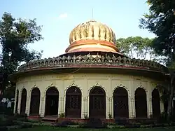
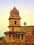
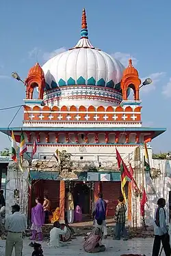
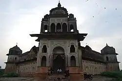
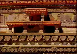
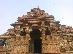
SL. No. Description Location Address District Coordinates Image S-MP-1 Fort Sendhwa Sendhwa Barwani 21°41′19″N 75°05′44″E / 21.68854°N 75.09542°E / 21.68854; 75.09542 (SL. No. S-MP-1 ) Fort Sendhwa S-MP-2 Ancient Bavdi Jalgone Barwani 21°40′47″N 74°43′05″E / 21.67975°N 74.71795°E / 21.67975; 74.71795 (SL. No. S-MP-2 ) Upload Photo S-MP-3 Hatta ki Bavdi Hatta Balaghat 21°43′15″N 80°16′22″E / 21.72082°N 80.27272°E / 21.72082; 80.27272 (SL. No. S-MP-3 ) Upload Photo S-MP-4 Ancient Shiva Temple Bhainsdehi Betul 21°38′58″N 77°38′07″E / 21.64938°N 77.63531°E / 21.64938; 77.63531 (SL. No. S-MP-4 ) Ancient Shiva Temple S-MP-5 Digambar Jaina Temple, Cave No. 10 Muktagiri Betul 21°24′04″N 77°34′23″E / 21.40108°N 77.57315°E / 21.40108; 77.57315 (SL. No. S-MP-5 ) Digambar Jaina Temple, Cave No. 10 S-MP-6 Pandava ki Kacheri (Shiva Temple) Salbardi Betul 21°25′32″N 78°00′38″E / 21.42546°N 78.01049°E / 21.42546; 78.01049 (SL. No. S-MP-6 ) Upload Photo S-MP-7 Rishi Baba and Mata Mai ka Mandir Dohlan Betul 21°41′05″N 78°05′35″E / 21.68483°N 78.0931°E / 21.68483; 78.0931 (SL. No. S-MP-7 ) Upload Photo S-MP-8 Shiva Temple Dang Bhind 26°27′42″N 78°27′18″E / 26.46158°N 78.45496°E / 26.46158; 78.45496 (SL. No. S-MP-8 ) Upload Photo S-MP-9 Shiva Temple Birkhadi Bhind 26°28′21″N 78°28′27″E / 26.47248°N 78.47406°E / 26.47248; 78.47406 (SL. No. S-MP-9 ) Upload Photo S-MP-10 Gohad Fort Banipura Bhind 26°25′33″N 78°26′48″E / 26.4258°N 78.44653°E / 26.4258; 78.44653 (SL. No. S-MP-10 ) Gohad Fort S-MP-11 Ancient site (a) Rahkola Devi temple,(b) ancient mound Daboh Bhind 25°59′18″N 78°53′28″E / 25.98833°N 78.89113°E / 25.98833; 78.89113 (SL. No. S-MP-11 ) Upload Photo S-MP-12 Naya Mahal Banipura Bhind 26°25′24″N 78°26′54″E / 26.42346°N 78.44833°E / 26.42346; 78.44833 (SL. No. S-MP-12 ) Naya Mahal S-MP-13 Devi Temple Chomho Bhind 26°43′09″N 78°37′32″E / 26.7193°N 78.62542°E / 26.7193; 78.62542 (SL. No. S-MP-13 ) Upload Photo S-MP-14 Sitaram temple Lawan Bhind 26°31′15″N 78°27′02″E / 26.52096°N 78.45051°E / 26.52096; 78.45051 (SL. No. S-MP-14 ) Upload Photo S-MP-15 Vishnu Temple Barahed Bhind 26°29′14″N 78°15′10″E / 26.48709°N 78.25273°E / 26.48709; 78.25273 (SL. No. S-MP-15 ) Upload Photo S-MP-16 Lakshman Temple Banipura Bhind 26°25′24″N 78°26′47″E / 26.42325°N 78.44645°E / 26.42325; 78.44645 (SL. No. S-MP-16 ) Upload Photo S-MP-17 Boreshwar Temple Boreshwar Bhind 26°40′49″N 78°45′59″E / 26.68028°N 78.76651°E / 26.68028; 78.76651 (SL. No. S-MP-17 ) Upload Photo S-MP-18 Fort and Darbar Hall Bhind Bhind 26°33′34″N 78°47′44″E / 26.55943°N 78.79544°E / 26.55943; 78.79544 (SL. No. S-MP-18 ) Upload Photo S-MP-19 Shiva Temple Ater Bhind 26°44′51″N 78°38′04″E / 26.74757°N 78.63448°E / 26.74757; 78.63448 (SL. No. S-MP-19 ) Upload Photo S-MP-20 Devi temple Ater Bhind 26°44′52″N 78°38′04″E / 26.74783°N 78.63443°E / 26.74783; 78.63443 (SL. No. S-MP-20 ) Upload Photo S-MP-21 Shiva Temple Lawan Bhind 26°31′22″N 78°27′11″E / 26.52276°N 78.45303°E / 26.52276; 78.45303 (SL. No. S-MP-21 ) Upload Photo S-MP-22 Ancient temple Chhimaka Bhind 26°26′46″N 78°23′57″E / 26.44613°N 78.39911°E / 26.44613; 78.39911 (SL. No. S-MP-22 ) Upload Photo S-MP-23 Ancient brick temple(Surya Mandir, Kupia Deva mandir) Bharoli Kalan Bhind 26°26′29″N 78°49′36″E / 26.44125°N 78.82668°E / 26.44125; 78.82668 (SL. No. S-MP-23 ) Upload Photo S-MP-24 Vishnu Temple Barhad Bhind 26°28′25″N 78°33′33″E / 26.47353°N 78.55929°E / 26.47353; 78.55929 (SL. No. S-MP-24 ) Upload Photo S-MP-25 Shiva Temple Chomho Bhind 26°43′10″N 78°37′32″E / 26.71939°N 78.62542°E / 26.71939; 78.62542 (SL. No. S-MP-25 ) Upload Photo S-MP-26 Chhatri of Malhar Rao Holkar Alampur Bhind 26°01′22″N 78°47′56″E / 26.02279°N 78.79889°E / 26.02279; 78.79889 (SL. No. S-MP-26 ) Upload Photo S-MP-27 Chaman Mahal Islamnagar, Bhopal Bhopal 23°21′28″N 77°25′04″E / 23.35768°N 77.41787°E / 23.35768; 77.41787 (SL. No. S-MP-27 ) Chaman Mahal S-MP-28 Rani Mahal Islamnagar, Bhopal Bhopal 23°21′28″N 77°25′04″E / 23.35785°N 77.41788°E / 23.35785; 77.41788 (SL. No. S-MP-28 ) Rani Mahal S-MP-29 Gond Mahal Islamnagar, Bhopal Bhopal 23°21′25″N 77°24′56″E / 23.35706°N 77.41554°E / 23.35706; 77.41554 (SL. No. S-MP-29 ) Gond Mahal S-MP-30 Fort Wall Islamnagar, Bhopal Bhopal 23°21′21″N 77°25′01″E / 23.35596°N 77.41701°E / 23.35596; 77.41701 (SL. No. S-MP-30 ) Fort Wall S-MP-31 Taj Mahal Palace Bhopal Bhopal 23°15′00″N 77°25′00″E / 23.25003°N 77.41666°E / 23.25003; 77.41666 (SL. No. S-MP-31 ) Taj Mahal Palace S-MP-32 Golghar Museum Bhopal Bhopal 23°16′05″N 77°23′25″E / 23.26815°N 77.39016°E / 23.26815; 77.39016 (SL. No. S-MP-32 ) Golghar Museum S-MP-33 Mausoleum of Dost Khan and Fateh Bibi Bhopal Bhopal 23°15′33″N 77°23′28″E / 23.25905°N 77.39115°E / 23.25905; 77.39115 (SL. No. S-MP-33 ) Mausoleum of Dost Khan and Fateh Bibi S-MP-34 Akbari Sarai Burhanpur Burhanpur 21°18′39″N 76°14′04″E / 21.31095°N 76.23433°E / 21.31095; 76.23433 (SL. No. S-MP-34 ) Upload Photo S-MP-35 Rao Ratan Mahal Ratanpura Burhanpur 21°17′18″N 76°12′21″E / 21.28821°N 76.20572°E / 21.28821; 76.20572 (SL. No. S-MP-35 ) Upload Photo S-MP-36 Zainabad Sarai and Masjid Zainabad Burhanpur 21°18′08″N 76°14′40″E / 21.30231°N 76.24447°E / 21.30231; 76.24447 (SL. No. S-MP-36 ) Upload Photo S-MP-37 Baradari Burhanpur Burhanpur 21°17′24″N 76°13′24″E / 21.28992°N 76.22331°E / 21.28992; 76.22331 (SL. No. S-MP-37 ) Upload Photo S-MP-38 Tomb of Begum Mumtaz Mahal Ahukhana Burhanpur 21°18′48″N 76°14′37″E / 21.31332°N 76.24356°E / 21.31332; 76.24356 (SL. No. S-MP-38 ) Upload Photo S-MP-39 Mausoleum of Sahzada Parvez Burhanpur Burhanpur 21°18′52″N 76°13′22″E / 21.31435°N 76.22276°E / 21.31435; 76.22276 (SL. No. S-MP-39 ) Upload Photo S-MP-40 Mausoleum of Daulat Khan Lodhi Burhanpur Burhanpur 21°19′38″N 76°13′31″E / 21.32711°N 76.22526°E / 21.32711; 76.22526 (SL. No. S-MP-40 ) Upload Photo S-MP-41 Moti Mahal Asirgarh Burhanpur 21°28′48″N 76°16′47″E / 21.48005°N 76.27977°E / 21.48005; 76.27977 (SL. No. S-MP-41 ) Upload Photo S-MP-42 Shantinath Jain Temple Uradmau Chhatarpur 25°05′14″N 79°44′55″E / 25.08736°N 79.74867°E / 25.08736; 79.74867 (SL. No. S-MP-42 ) Upload Photo S-MP-43 Chatrasal ka Makbara Mau Sahaniya Chhatarpur 24°59′56″N 79°28′49″E / 24.99879°N 79.48035°E / 24.99879; 79.48035 (SL. No. S-MP-43 ) Chatrasal ka Makbara S-MP-44 Dhubela Mahal Mau Sahaniya Chhatarpur 25°00′29″N 79°28′47″E / 25.00798°N 79.47971°E / 25.00798; 79.47971 (SL. No. S-MP-44 ) Dhubela Mahal S-MP-45 Maharani Kamlapati samadhi Mau Sahaniya Chhatarpur 25°00′13″N 79°28′37″E / 25.00355°N 79.47695°E / 25.00355; 79.47695 (SL. No. S-MP-45 ) Maharani Kamlapati samadhi S-MP-46 Shiv Yogini Temple Barat Saderi Chhatarpur 25°02′35″N 79°31′14″E / 25.04294°N 79.52067°E / 25.04294; 79.52067 (SL. No. S-MP-46 ) Upload Photo S-MP-47 Bhimkund Group of Temples Mau Sahaniya Chhatarpur 25°00′25″N 79°28′26″E / 25.00681°N 79.47399°E / 25.00681; 79.47399 (SL. No. S-MP-47 ) Upload Photo S-MP-48 Ganesh Temple (Gola Math) Mau Sahaniya Chhatarpur Upload Photo S-MP-49 Nagmandir Mau Sahaniya Chhatarpur 25°00′57″N 79°29′08″E / 25.01595°N 79.4856°E / 25.01595; 79.4856 (SL. No. S-MP-49 ) Upload Photo S-MP-50 Ancient Shiva Temple Khadgayn Chouka Chhatarpur 24°50′04″N 79°29′19″E / 24.83458°N 79.48862°E / 24.83458; 79.48862 (SL. No. S-MP-50 ) Upload Photo S-MP-51 Surya Temple Banjari Chhatarpur 25°00′05″N 80°11′07″E / 25.00135°N 80.18537°E / 25.00135; 80.18537 (SL. No. S-MP-51 ) Upload Photo S-MP-52 Pournkadanta, Painted rock shelter Deora, Bijawar Chhatarpur 24°34′40″N 79°39′28″E / 24.57772°N 79.65785°E / 24.57772; 79.65785 (SL. No. S-MP-52 ) Upload Photo S-MP-53 Putlikadanta, Painted rockshelter Deora, Bijawar Chhatarpur 24°34′40″N 79°39′28″E / 24.57772°N 79.65785°E / 24.57772; 79.65785 (SL. No. S-MP-53 ) Upload Photo S-MP-54 Devra ka Kila Deora, Bijawar Chhatarpur 24°35′20″N 79°38′33″E / 24.58875°N 79.6424°E / 24.58875; 79.6424 (SL. No. S-MP-54 ) Upload Photo S-MP-55 Dhanushdhari Temple Alipura, Nowgaon Chhatarpur 25°10′33″N 79°20′49″E / 25.17579°N 79.34684°E / 25.17579; 79.34684 (SL. No. S-MP-55 ) Upload Photo S-MP-56 Bihariju Temple Mau Sahania Chhatarpur 25°01′16″N 79°29′37″E / 25.02103°N 79.49357°E / 25.02103; 79.49357 (SL. No. S-MP-56 ) Upload Photo S-MP-57 Tomb of Sawai Singh Mau Sahaniya Chhatarpur 25°00′10″N 79°29′44″E / 25.00279°N 79.49556°E / 25.00279; 79.49556 (SL. No. S-MP-57 ) Tomb of Sawai Singh S-MP-58 Tomb of Bercha Rani Maheba Chhatarpur 24°59′11″N 79°29′27″E / 24.98643°N 79.49097°E / 24.98643; 79.49097 (SL. No. S-MP-58 ) Upload Photo S-MP-59 Maheba Gate Maheba Chhatarpur 24°59′43″N 79°28′38″E / 24.99533°N 79.47726°E / 24.99533; 79.47726 (SL. No. S-MP-59 ) Maheba Gate S-MP-60 Chaturbhurj Temple Achatt Chhatarpur 24°58′47″N 79°21′17″E / 24.97978°N 79.35479°E / 24.97978; 79.35479 (SL. No. S-MP-60 ) Upload Photo S-MP-61 Shiva Temple Hindorabari Chhatarpur 25°05′22″N 80°06′54″E / 25.08938°N 80.11511°E / 25.08938; 80.11511 (SL. No. S-MP-61 ) Upload Photo S-MP-62 Shiva Temple Brijpura Chhatarpur Upload Photo S-MP-63 Shiva Temple Byas Badaura Chhatarpur 25°05′02″N 80°15′21″E / 25.08389°N 80.25591°E / 25.08389; 80.25591 (SL. No. S-MP-63 ) Shiva Temple S-MP-64 Ancient Devi Temple Byas Badaura Chhatarpur 25°04′59″N 80°15′23″E / 25.08311°N 80.25638°E / 25.08311; 80.25638 (SL. No. S-MP-64 ) Ancient Devi Temple S-MP-65 Gulganj Fort Gulganj Chhatarpur 24°41′57″N 79°22′29″E / 24.69917°N 79.37477°E / 24.69917; 79.37477 (SL. No. S-MP-65 ) Gulganj Fort S-MP-66 Chhatri of Maharaja Pratap Singh Khajuraho Chhatarpur 24°51′08″N 79°55′25″E / 24.8521°N 79.92365°E / 24.8521; 79.92365 (SL. No. S-MP-66 ) Chhatri of Maharaja Pratap Singh S-MP-67 Temple Pratap Juu Chhatarpur Upload Photo S-MP-68 Shiva Yogini Temple Byas Badaura Chhatarpur 25°04′59″N 80°15′24″E / 25.08316°N 80.25674°E / 25.08316; 80.25674 (SL. No. S-MP-68 ) Shiva Yogini Temple S-MP-69 Kishangadh ki Gadhi Kishangadh Chhatarpur 24°28′09″N 79°44′54″E / 24.46919°N 79.74831°E / 24.46919; 79.74831 (SL. No. S-MP-69 ) Upload Photo S-MP-70 Rukmani Math Kundalpur Damoh 23°59′30″N 79°43′16″E / 23.99172°N 79.72109°E / 23.99172; 79.72109 (SL. No. S-MP-70 ) Upload Photo S-MP-71 Damyanti Gadhi Damoh Damoh 23°49′50″N 79°26′31″E / 23.83062°N 79.44208°E / 23.83062; 79.44208 (SL. No. S-MP-71 ) Upload Photo S-MP-72 Chhatri of Maharaja Parikshit Datia Datia 25°40′13″N 78°28′08″E / 25.67036°N 78.4689°E / 25.67036; 78.4689 (SL. No. S-MP-72 ) Upload Photo S-MP-73 Chhatri of Maharaja Indrajeet Datia Datia 25°40′14″N 78°28′09″E / 25.67046°N 78.46919°E / 25.67046; 78.46919 (SL. No. S-MP-73 ) Upload Photo S-MP-74 Chhatri of Bhavani Singh Datia Datia 25°40′11″N 78°28′08″E / 25.66979°N 78.46877°E / 25.66979; 78.46877 (SL. No. S-MP-74 ) Upload Photo S-MP-75 Chhatri of Maharaja Shahkarna Datia Datia 25°40′14″N 78°28′10″E / 25.67069°N 78.46943°E / 25.67069; 78.46943 (SL. No. S-MP-75 ) Upload Photo S-MP-76 Shiva Temple Bharoli Datia Upload Photo S-MP-77 Surai Sikandarpura Datia Upload Photo S-MP-78 Shiva Temple Jamli Dhar 22°28′52″N 74°58′52″E / 22.4812°N 74.98116°E / 22.4812; 74.98116 (SL. No. S-MP-78 ) Upload Photo S-MP-79 Dhar Durg Dhar Dhar 22°36′04″N 75°18′15″E / 22.60102°N 75.30411°E / 22.60102; 75.30411 (SL. No. S-MP-79 ) Dhar Durg S-MP-80 Kharbuja Mahal Dhar Dhar 22°36′08″N 75°18′11″E / 22.60216°N 75.30299°E / 22.60216; 75.30299 (SL. No. S-MP-80 ) Kharbuja Mahal S-MP-81 Koteshwar Temple Nagjhiri Dhar 22°54′39″N 75°09′13″E / 22.91081°N 75.15348°E / 22.91081; 75.15348 (SL. No. S-MP-81 ) Upload Photo S-MP-82 Baijnath Temple Badnawar Dhar 23°01′17″N 75°14′18″E / 23.02131°N 75.23842°E / 23.02131; 75.23842 (SL. No. S-MP-82 ) Upload Photo S-MP-83 Chappan Mahal Mandu Dhar 22°20′34″N 75°23′52″E / 22.34264°N 75.3979°E / 22.34264; 75.3979 (SL. No. S-MP-83 ) Chappan Mahal S-MP-84 Chaturbhurj Temple Amjhera Dhar 22°33′33″N 75°06′53″E / 22.55912°N 75.11466°E / 22.55912; 75.11466 (SL. No. S-MP-84 ) Upload Photo S-MP-85 Malcolm Kothi Nalchha Dhar 22°25′48″N 75°24′13″E / 22.42999°N 75.4036°E / 22.42999; 75.4036 (SL. No. S-MP-85 ) Upload Photo S-MP-86 Andha Mahal Sulibardi Dhar 22°21′51″N 75°23′17″E / 22.36425°N 75.38804°E / 22.36425; 75.38804 (SL. No. S-MP-86 ) Andha Mahal S-MP-87 Madankui Sarai Mandu Dhar 22°21′18″N 75°23′47″E / 22.35488°N 75.39649°E / 22.35488; 75.39649 (SL. No. S-MP-87 ) Upload Photo S-MP-88 Kothari Sarai Mandu Dhar 22°20′22″N 75°23′59″E / 22.33952°N 75.39981°E / 22.33952; 75.39981 (SL. No. S-MP-88 ) Kothari Sarai S-MP-89 Roja ka Makbara Mandu Dhar 22°20′08″N 75°23′57″E / 22.33569°N 75.39916°E / 22.33569; 75.39916 (SL. No. S-MP-89 ) Roja ka Makbara S-MP-90 Phuta Mandir (Broken) Mandu Dhar 22°20′02″N 75°24′00″E / 22.33377°N 75.39999°E / 22.33377; 75.39999 (SL. No. S-MP-90 ) Upload Photo S-MP-91 Two Chhatris of Nayapur Chanderi Ashoknagar 24°43′07″N 78°08′03″E / 24.71849°N 78.13418°E / 24.71849; 78.13418 (SL. No. S-MP-91 ) Upload Photo S-MP-92 Two Chhatris of Chakla Bavri Chanderi Ashoknagar 24°42′31″N 78°08′10″E / 24.70861°N 78.13615°E / 24.70861; 78.13615 (SL. No. S-MP-92 ) Upload Photo S-MP-93 Samadhi of Maharani Lakshmibai Gwalior Gwalior 26°12′44″N 78°10′24″E / 26.21219°N 78.17344°E / 26.21219; 78.17344 (SL. No. S-MP-93 ) Samadhi of Maharani Lakshmibai S-MP-94 Raslilaghar Gwalior Gwalior 26°07′05″N 78°00′31″E / 26.11805°N 78.00865°E / 26.11805; 78.00865 (SL. No. S-MP-94 ) Upload Photo S-MP-95 Moti Mahal Gwalior Gwalior 26°12′28″N 78°10′22″E / 26.20764°N 78.17285°E / 26.20764; 78.17285 (SL. No. S-MP-95 ) Moti Mahal S-MP-96 Gwalior Fort (wall and Burj) Gwalior Gwalior 26°13′40″N 78°10′09″E / 26.22767°N 78.1692°E / 26.22767; 78.1692 (SL. No. S-MP-96 ) Gwalior Fort (wall and Burj)More images S-MP-97 Karnamahal Gwalior Gwalior 26°13′54″N 78°10′09″E / 26.23157°N 78.16909°E / 26.23157; 78.16909 (SL. No. S-MP-97 ) Karnamahal S-MP-98 Vikram mahal Gwalior Gwalior 26°13′53″N 78°10′10″E / 26.23152°N 78.16952°E / 26.23152; 78.16952 (SL. No. S-MP-98 ) Vikram mahal S-MP-99 Jahangir mahal and Shahjahan Mahal Gwalior Gwalior 26°13′57″N 78°10′12″E / 26.23253°N 78.16989°E / 26.23253; 78.16989 (SL. No. S-MP-99 ) Jahangir mahal and Shahjahan Mahal S-MP-100 Jauhar kund Gwalior Gwalior 26°13′59″N 78°10′09″E / 26.23317°N 78.16917°E / 26.23317; 78.16917 (SL. No. S-MP-100 ) Jauhar kund S-MP-101 Chhatri of Bhimsena Rana Gwalior Gwalior 26°14′01″N 78°10′10″E / 26.23354°N 78.16932°E / 26.23354; 78.16932 (SL. No. S-MP-101 ) Chhatri of Bhimsena Rana S-MP-102 Gujri Mahal Gwalior Gwalior 26°14′03″N 78°10′14″E / 26.23404°N 78.17064°E / 26.23404; 78.17064 (SL. No. S-MP-102 ) Gujri Mahal More images S-MP-103 Dhumeshwar Mahadeva Temple Dhumeshwar Gwalior 25°45′27″N 78°13′32″E / 25.75758°N 78.22558°E / 25.75758; 78.22558 (SL. No. S-MP-103 ) Upload Photo S-MP-104 Ladhedi Gate Gwalior Gwalior 26°14′25″N 78°10′08″E / 26.2404°N 78.16884°E / 26.2404; 78.16884 (SL. No. S-MP-104 ) Upload Photo S-MP-105 Chhatri Barakhadkala, Seoni Malwa Harda Upload Photo S-MP-106 Teli ki Sarai Handia Harda 22°28′18″N 76°58′49″E / 22.47177°N 76.98018°E / 22.47177; 76.98018 (SL. No. S-MP-106 ) Teli ki Sarai S-MP-107 Riddheshwar Mahadev Temple Handia Harda 22°29′12″N 76°58′36″E / 22.48677°N 76.97655°E / 22.48677; 76.97655 (SL. No. S-MP-107 ) Riddheshwar Mahadev Temple S-MP-108 Chhatri of Bule Sarkar Indore Indore 22°43′10″N 75°51′35″E / 22.7194°N 75.85968°E / 22.7194; 75.85968 (SL. No. S-MP-108 ) Chhatri of Bule Sarkar S-MP-109 Chhatri of Krishnabai Holkar Indore Indore 22°43′08″N 75°51′29″E / 22.71878°N 75.85802°E / 22.71878; 75.85802 (SL. No. S-MP-109 ) Chhatri of Krishnabai Holkar S-MP-110 Rajwada Mahal, Chauk, Image of Ahilyabai and garden Indore Indore 22°43′06″N 75°51′19″E / 22.71841°N 75.85518°E / 22.71841; 75.85518 (SL. No. S-MP-110 ) Rajwada Mahal, Chauk, Image of Ahilyabai and garden S-MP-111 Lalbagh Palace Indore Indore 22°42′00″N 75°50′50″E / 22.70005°N 75.84709°E / 22.70005; 75.84709 (SL. No. S-MP-111 ) Lalbagh Palace S-MP-112 Fort of Kushalgadh Kushalgadh Indore 22°28′05″N 75°50′15″E / 22.46805°N 75.83746°E / 22.46805; 75.83746 (SL. No. S-MP-112 ) Upload Photo S-MP-113 Shankar Math Kunda, Sihora Jabalpur Upload Photo S-MP-114 Ram Mandir Matiakui, Jabalpur Jabalpur Upload Photo S-MP-115 Vishnu Varaha Temple Majholi Jabalpur 23°30′11″N 79°55′21″E / 23.50308°N 79.92258°E / 23.50308; 79.92258 (SL. No. S-MP-115 ) Upload Photo S-MP-116 Mudhiya Shiva Temple Garha Jabalpur Upload Photo S-MP-117 Four Images on a Boulder Sindursi, Sihora Jabalpur Upload Photo S-MP-118 Image of Maladevi Jabalpur Jabalpur 23°09′18″N 79°53′10″E / 23.15499°N 79.88617°E / 23.15499; 79.88617 (SL. No. S-MP-118 ) Upload Photo S-MP-119 Inscription and Engraved Images of Tirthankaras Imaliya, Sihora Jabalpur Upload Photo S-MP-120 Vishnu Varaha Temple Bhita Jabalpur 23°11′11″N 79°37′03″E / 23.18649°N 79.61749°E / 23.18649; 79.61749 (SL. No. S-MP-120 ) Upload Photo S-MP-121 Pachmatha Temple Jabalpur Jabalpur 23°09′33″N 79°54′22″E / 23.1592°N 79.90606°E / 23.1592; 79.90606 (SL. No. S-MP-121 ) Upload Photo S-MP-122 Panchlingeshwar Shiva Temple Malwai Jhabua 22°15′55″N 74°20′52″E / 22.26519°N 74.34774°E / 22.26519; 74.34774 (SL. No. S-MP-122 ) Upload Photo S-MP-123 Shiva Temple Devalphalia Jhabua 22°36′13″N 74°27′03″E / 22.60367°N 74.45079°E / 22.60367; 74.45079 (SL. No. S-MP-123 ) Upload Photo S-MP-124 Bawadi Hanuman Temple Thandala Jhabua 23°00′23″N 74°34′43″E / 23.0065°N 74.5787°E / 23.0065; 74.5787 (SL. No. S-MP-124 ) Upload Photo S-MP-125 Place of Jogiya Baba and three images kept there Dithwara Katni 23°56′22″N 80°27′53″E / 23.93952°N 80.4646°E / 23.93952; 80.4646 (SL. No. S-MP-125 ) Place of Jogiya Baba and three images kept there S-MP-126 Painted Rock- shelters, Nos. 1 to 15 Jhinjhari Katni 23°48′08″N 80°21′51″E / 23.8021°N 80.36404°E / 23.8021; 80.36404 (SL. No. S-MP-126 ) Upload Photo S-MP-127 Kalimata ki Madhiya Karitalai Katni Upload Photo S-MP-128 Vijayaraghavgadh Fort Vijayraghavgarh Katni 23°59′22″N 80°36′20″E / 23.98956°N 80.60545°E / 23.98956; 80.60545 (SL. No. S-MP-128 ) Vijayaraghavgadh Fort S-MP-129 Gauri Somnath Temple Omkareshwar Khandwa 22°15′01″N 76°08′53″E / 22.25038°N 76.14805°E / 22.25038; 76.14805 (SL. No. S-MP-129 ) Gauri Somnath Temple S-MP-130 Siddheshwar Temple Omkareshwar Khandwa Upload Photo S-MP-131 Parvati Temple Omkareshwar Khandwa Upload Photo S-MP-132 Ballaleshwar Temple Un Khargone 21°49′26″N 75°27′03″E / 21.82379°N 75.45093°E / 21.82379; 75.45093 (SL. No. S-MP-132 ) Ballaleshwar Temple S-MP-133 Moti Mahal, Mandla Ramnagar Mandla 22°36′52″N 80°30′41″E / 22.61456°N 80.51128°E / 22.61456; 80.51128 (SL. No. S-MP-133 ) Moti Mahal, Mandla S-MP-134 Kothi of Raibhagat Ramnagar Mandla 22°36′50″N 80°30′57″E / 22.61388°N 80.51582°E / 22.61388; 80.51582 (SL. No. S-MP-134 ) Upload Photo S-MP-135 Gadhi Raja Narendra Shah Mandla Mandla 22°35′16″N 80°22′11″E / 22.58765°N 80.36964°E / 22.58765; 80.36964 (SL. No. S-MP-135 ) Upload Photo S-MP-136 Vishnu Temple Ramnagar Mandla 22°36′48″N 80°30′38″E / 22.61341°N 80.51069°E / 22.61341; 80.51069 (SL. No. S-MP-136 ) Upload Photo S-MP-137 Mahal and Bavdi of Gond Raja Simariya Mandla 22°29′11″N 79°01′18″E / 22.48636°N 79.02167°E / 22.48636; 79.02167 (SL. No. S-MP-137 ) Upload Photo S-MP-138 Image of Surya (Temple Ruins) Mandla Mandla 22°35′36″N 80°22′04″E / 22.59342°N 80.36773°E / 22.59342; 80.36773 (SL. No. S-MP-138 ) Upload Photo S-MP-139 Gadhi of Hridayshah Jagnathar Mandla 22°30′23″N 80°29′13″E / 22.50643°N 80.48689°E / 22.50643; 80.48689 (SL. No. S-MP-139 ) Upload Photo S-MP-140 Varaha Temple Kohala Mandsaur 24°32′03″N 75°39′05″E / 24.53406°N 75.65141°E / 24.53406; 75.65141 (SL. No. S-MP-140 ) Upload Photo S-MP-141 Group of rock cut cave temples Pola Dungar Kharkheda Mandsaur 24°14′59″N 75°45′21″E / 24.24975°N 75.75582°E / 24.24975; 75.75582 (SL. No. S-MP-141 ) Upload Photo S-MP-142 Thakur Chaman Singh ki Gadhi Acheri Mandsaur 24°01′40″N 74°59′24″E / 24.02766°N 74.9901°E / 24.02766; 74.9901 (SL. No. S-MP-142 ) Upload Photo S-MP-143 Yashwant Rao Holkar Chhatri Bhanpura Mandsaur 24°31′02″N 75°44′19″E / 24.51714°N 75.73851°E / 24.51714; 75.73851 (SL. No. S-MP-143 ) Upload Photo S-MP-144 Lakshmi Narain Temple Neemthur Mandsaur 24°31′39″N 75°48′24″E / 24.5276°N 75.80658°E / 24.5276; 75.80658 (SL. No. S-MP-144 ) Upload Photo S-MP-145 Dudheshwar Mahadeva Temple Chirmoliya Mandsaur 24°01′14″N 75°15′19″E / 24.02063°N 75.25536°E / 24.02063; 75.25536 (SL. No. S-MP-145 ) Upload Photo S-MP-146 Ancient Caves and Temples Khejdiyabhop Mandsaur 23°59′33″N 75°43′54″E / 23.99246°N 75.73159°E / 23.99246; 75.73159 (SL. No. S-MP-146 ) Upload Photo S-MP-147 Suraj Temple Khilchipura Mandsaur 24°02′37″N 75°04′18″E / 24.04364°N 75.07175°E / 24.04364; 75.07175 (SL. No. S-MP-147 ) Upload Photo S-MP-148 Toran Barda Ghasoi Mandsaur Upload Photo S-MP-149 Hingalajgadh Durg Hinglajgarh Mandsaur 24°40′02″N 75°47′12″E / 24.66727°N 75.78654°E / 24.66727; 75.78654 (SL. No. S-MP-149 ) Hingalajgadh Durg S-MP-150 Sabalgarh fort Sabalgarh Morena 26°14′27″N 77°24′25″E / 26.24093°N 77.40681°E / 26.24093; 77.40681 (SL. No. S-MP-150 ) Sabalgarh fort S-MP-151 Surya temple (ancient temple, baradari) Aiti Morena 26°23′40″N 78°13′06″E / 26.39447°N 78.21823°E / 26.39447; 78.21823 (SL. No. S-MP-151 ) Surya temple (ancient temple, baradari) S-MP-152 Vishnu Temple Aiti Morena 26°23′44″N 78°13′09″E / 26.39557°N 78.21915°E / 26.39557; 78.21915 (SL. No. S-MP-152 ) Vishnu Temple S-MP-153 Ancient temple (Shiva Temple) Bhainsora Morena 26°28′20″N 78°13′33″E / 26.47214°N 78.22597°E / 26.47214; 78.22597 (SL. No. S-MP-153 ) Upload Photo S-MP-154 Vishnu temple Barahwali Morena 26°24′43″N 78°12′22″E / 26.41189°N 78.20622°E / 26.41189; 78.20622 (SL. No. S-MP-154 ) Upload Photo S-MP-155 Shiva Temple (ancient temple, gadhi ruins) Barahwali Morena 26°24′59″N 78°13′23″E / 26.41651°N 78.22308°E / 26.41651; 78.22308 (SL. No. S-MP-155 ) Upload Photo S-MP-156 Gadhi and Mahal Husainpur Morena 26°37′20″N 77°56′33″E / 26.62212°N 77.9424°E / 26.62212; 77.9424 (SL. No. S-MP-156 ) Upload Photo S-MP-157 Ganna Begam ka Makbara Nurabad Morena 26°24′15″N 78°04′02″E / 26.40411°N 78.06722°E / 26.40411; 78.06722 (SL. No. S-MP-157 ) Upload Photo S-MP-158 Shiva Mandir (ruins) Ardauni Morena 26°27′36″N 78°11′34″E / 26.45987°N 78.19275°E / 26.45987; 78.19275 (SL. No. S-MP-158 ) Upload Photo S-MP-159 Mahadeva Temple Amleda Morena 26°26′16″N 78°14′59″E / 26.43784°N 78.2496°E / 26.43784; 78.2496 (SL. No. S-MP-159 ) Upload Photo S-MP-160 Gadhi Sumaoli Morena 26°22′28″N 77°54′59″E / 26.37444°N 77.91652°E / 26.37444; 77.91652 (SL. No. S-MP-160 ) Upload Photo S-MP-161 Chaugan Fort Chougan Narsinghpur 22°45′31″N 78°55′39″E / 22.7585°N 78.92749°E / 22.7585; 78.92749 (SL. No. S-MP-161 ) Upload Photo S-MP-162 Pandava Math Barheta Narsinghpur 22°53′47″N 79°23′48″E / 22.89632°N 79.39663°E / 22.89632; 79.39663 (SL. No. S-MP-162 ) Upload Photo S-MP-163 Someshwar Temple Barmaan Narsinghpur 23°01′50″N 79°01′15″E / 23.03067°N 79.02094°E / 23.03067; 79.02094 (SL. No. S-MP-163 ) Upload Photo S-MP-164 Ancient Garuda Stambha Barmaan Narsinghpur 23°01′49″N 79°01′15″E / 23.03017°N 79.02074°E / 23.03017; 79.02074 (SL. No. S-MP-164 ) Upload Photo S-MP-165 Image of Ambika Devi Bachai Narsinghpur 22°52′26″N 79°18′06″E / 22.87382°N 79.30156°E / 22.87382; 79.30156 (SL. No. S-MP-165 ) Upload Photo S-MP-166 Chaturbhuji Balaji ki Madhiya Bachai Narsinghpur 22°52′26″N 79°18′06″E / 22.87382°N 79.30156°E / 22.87382; 79.30156 (SL. No. S-MP-166 ) Upload Photo S-MP-167 Fort and Jogeshwar Bhagwan Temple Sangwan Narmadapuram 22°04′02″N 76°56′22″E / 22.06715°N 76.93955°E / 22.06715; 76.93955 (SL. No. S-MP-167 ) Upload Photo S-MP-168 Tilak Sindoor Temple Khatama Narmadapuram 22°29′30″N 77°43′40″E / 22.4918°N 77.72772°E / 22.4918; 77.72772 (SL. No. S-MP-168 ) Upload Photo S-MP-169 Ancient Temple Khor Neemuch 24°35′26″N 74°48′51″E / 24.59043°N 74.81424°E / 24.59043; 74.81424 (SL. No. S-MP-169 ) Upload Photo S-MP-170 Panchdeval Jiran Neemuch 24°18′05″N 74°53′15″E / 24.30149°N 74.88737°E / 24.30149; 74.88737 (SL. No. S-MP-170 ) Upload Photo S-MP-171 Mandir Jiran Neemuch 24°18′05″N 74°53′14″E / 24.30143°N 74.88729°E / 24.30143; 74.88729 (SL. No. S-MP-171 ) Upload Photo S-MP-172 Jiran Ki Gadhi Jiran Neemuch 24°18′28″N 74°53′21″E / 24.30781°N 74.88907°E / 24.30781; 74.88907 (SL. No. S-MP-172 ) Jiran Ki Gadhi S-MP-173 Chhatri of Bhanu Tikait Jiran Neemuch 24°18′06″N 74°53′14″E / 24.30154°N 74.88731°E / 24.30154; 74.88731 (SL. No. S-MP-173 ) Upload Photo S-MP-174 Shiva Temple Jiran Neemuch 24°17′59″N 74°53′15″E / 24.2998°N 74.88761°E / 24.2998; 74.88761 (SL. No. S-MP-174 ) Upload Photo S-MP-175 Temple of Dhava Mata Nayagaon Neemuch 24°34′11″N 74°46′36″E / 24.5696°N 74.77659°E / 24.5696; 74.77659 (SL. No. S-MP-175 ) Upload Photo S-MP-176 Ancient Temple-2 Barukheda Neemuch 24°29′18″N 74°53′30″E / 24.48824°N 74.89166°E / 24.48824; 74.89166 (SL. No. S-MP-176 ) Upload Photo S-MP-177 Ancient Temple-4 Barukheda Neemuch 24°29′34″N 74°53′25″E / 24.49276°N 74.8903°E / 24.49276; 74.8903 (SL. No. S-MP-177 ) Upload Photo S-MP-178 Ancient Temple-1 Barukheda Neemuch 24°29′14″N 74°53′27″E / 24.48718°N 74.89082°E / 24.48718; 74.89082 (SL. No. S-MP-178 ) Upload Photo S-MP-179 Nand chand Shiv Temple Nand chand Panna 24°00′02″N 80°04′21″E / 24.00062°N 80.07254°E / 24.00062; 80.07254 (SL. No. S-MP-179 ) Nand chand Shiv Temple S-MP-180 Vishnuvaraha Temple and other Images Puraina Panna 23°57′34″N 80°18′34″E / 23.95939°N 80.30947°E / 23.95939; 80.30947 (SL. No. S-MP-180 ) Upload Photo S-MP-181 Dholiamath (Shiva Temple) Khamariya Panna 24°15′39″N 80°08′16″E / 24.26082°N 80.13773°E / 24.26082; 80.13773 (SL. No. S-MP-181 ) Upload Photo S-MP-182 Hindupat palace museum Panna Panna 24°43′00″N 80°11′25″E / 24.71662°N 80.1904°E / 24.71662; 80.1904 (SL. No. S-MP-182 ) Upload Photo S-MP-183 Solah Khambi Bihar Village Rajgarh 23°37′32″N 77°06′16″E / 23.62559°N 77.10444°E / 23.62559; 77.10444 (SL. No. S-MP-183 ) Solah Khambi S-MP-184 Mausoleum of Hajiwali Bihar Village Rajgarh 23°37′30″N 77°06′15″E / 23.62503°N 77.10412°E / 23.62503; 77.10412 (SL. No. S-MP-184 ) Upload Photo S-MP-185 Ancient Mosque Bihar Village Rajgarh 23°37′28″N 77°05′57″E / 23.62457°N 77.0991°E / 23.62457; 77.0991 (SL. No. S-MP-185 ) Upload Photo S-MP-186 Chhatri of Sankanji Sanka Jagir Rajgarh 23°35′57″N 77°07′32″E / 23.59914°N 77.12551°E / 23.59914; 77.12551 (SL. No. S-MP-186 ) Chhatri of Sankanji S-MP-187 Ancient Bavdi Machalpur Rajgarh 24°07′33″N 76°18′45″E / 24.1258°N 76.31251°E / 24.1258; 76.31251 (SL. No. S-MP-187 ) Upload Photo S-MP-188 Paniharin Temple Machalpur Rajgarh 24°07′32″N 76°19′32″E / 24.12558°N 76.3255°E / 24.12558; 76.3255 (SL. No. S-MP-188 ) Upload Photo S-MP-189 Grave of Rani Rupmati and Baz Bahadur Sarangpur Rajgarh 23°33′54″N 76°29′10″E / 23.56501°N 76.48604°E / 23.56501; 76.48604 (SL. No. S-MP-189 ) Upload Photo S-MP-190 Ruins of Jaina Temple and Images Ashapuri Raisen Upload Photo S-MP-191 Image of Goh (Mongoose?) and other images collected from the lower reach of the village Ashapuri Raisen 23°04′26″N 77°37′26″E / 23.07375°N 77.62387°E / 23.07375; 77.62387 (SL. No. S-MP-191 ) Upload Photo S-MP-192 Ashadevi Temple Ashapuri Raisen 23°04′47″N 77°37′38″E / 23.07986°N 77.62734°E / 23.07986; 77.62734 (SL. No. S-MP-192 ) Ashadevi Temple S-MP-193 Temple Ruins at Bilauta Bilauta Raisen 23°04′12″N 77°37′14″E / 23.07002°N 77.62066°E / 23.07002; 77.62066 (SL. No. S-MP-193 ) Upload Photo S-MP-194 Temple ruins on top of hill Ashapuri Raisen 23°04′49″N 77°37′50″E / 23.08023°N 77.63053°E / 23.08023; 77.63053 (SL. No. S-MP-194 ) Upload Photo S-MP-195 Bhutnath temple and Images Ashapuri Raisen 23°04′47″N 77°37′38″E / 23.0797°N 77.62733°E / 23.0797; 77.62733 (SL. No. S-MP-195 ) Bhutnath temple and Images S-MP-196 Bilpakeshwar Temple Bilpank Ratlam 23°13′31″N 75°08′47″E / 23.22523°N 75.14643°E / 23.22523; 75.14643 (SL. No. S-MP-196 ) Upload Photo S-MP-197 Mahakala Temple Dharad Ratlam 23°15′06″N 75°06′37″E / 23.25165°N 75.11015°E / 23.25165; 75.11015 (SL. No. S-MP-197 ) Upload Photo S-MP-198 Keoti Fort Keoti Rewa 24°49′01″N 81°27′24″E / 24.81699°N 81.45656°E / 24.81699; 81.45656 (SL. No. S-MP-198 ) Keoti Fort S-MP-199 Image of Bhairav Khamdiya Rewa 24°27′11″N 81°30′37″E / 24.45309°N 81.51035°E / 24.45309; 81.51035 (SL. No. S-MP-199 ) Image of Bhairav More images S-MP-200 Ancient Brick Temple Baijnath Rewa 24°30′04″N 81°10′24″E / 24.50125°N 81.17328°E / 24.50125; 81.17328 (SL. No. S-MP-200 ) Upload Photo S-MP-201 Gadhi Gurh Rewa 24°30′06″N 81°30′11″E / 24.50159°N 81.503°E / 24.50159; 81.503 (SL. No. S-MP-201 ) Upload Photo S-MP-202 Kudhiya Temple Mahsaw Rewa 24°30′47″N 81°25′19″E / 24.51307°N 81.42194°E / 24.51307; 81.42194 (SL. No. S-MP-202 ) Kudhiya Temple S-MP-203 Image of Hargauri Rewa Rewa 24°32′05″N 81°17′32″E / 24.53459°N 81.29216°E / 24.53459; 81.29216 (SL. No. S-MP-203 ) Upload Photo S-MP-204 Harsiddhi Devi Temple Rangir Sagar 23°37′06″N 78°55′20″E / 23.61832°N 78.92223°E / 23.61832; 78.92223 (SL. No. S-MP-204 ) Harsiddhi Devi Temple S-MP-205 Surya temple Rehli Sagar 23°38′03″N 79°03′53″E / 23.63412°N 79.06468°E / 23.63412; 79.06468 (SL. No. S-MP-205 ) Upload Photo S-MP-206 Shiva Temple Madhpiparia Sagar 23°14′27″N 79°01′31″E / 23.24081°N 79.02519°E / 23.24081; 79.02519 (SL. No. S-MP-206 ) Upload Photo S-MP-207 Digambar Jain Temple Patnaganj Rehli Sagar 23°38′04″N 79°04′06″E / 23.63438°N 79.0683°E / 23.63438; 79.0683 (SL. No. S-MP-207 ) Upload Photo S-MP-208 Sanodha Fort Sanodha Sagar 23°53′16″N 78°54′32″E / 23.88783°N 78.90892°E / 23.88783; 78.90892 (SL. No. S-MP-208 ) Upload Photo S-MP-209 Vishnu Temple Binaika Sagar 24°06′46″N 78°51′05″E / 24.11278°N 78.85128°E / 24.11278; 78.85128 (SL. No. S-MP-209 ) Upload Photo S-MP-210 Lady Dufferin Hospital now District Archaeological Museum Sagar Sagar Sagar 23°50′18″N 78°44′49″E / 23.83832°N 78.74703°E / 23.83832; 78.74703 (SL. No. S-MP-210 ) Lady Dufferin Hospital now District Archaeological Museum Sagar S-MP-211 Madhavagadh Fort Madhawgadh Satna 24°33′40″N 80°54′33″E / 24.56102°N 80.90921°E / 24.56102; 80.90921 (SL. No. S-MP-211 ) Madhavagadh Fort S-MP-212 Paitani Devi Gupta Period Temple Bihata Shankargarh Satna 24°26′04″N 80°46′42″E / 24.4345°N 80.77847°E / 24.4345; 80.77847 (SL. No. S-MP-212 ) Paitani Devi Gupta Period Temple S-MP-213 Gola Math Maihar Satna 24°16′05″N 80°44′47″E / 24.26801°N 80.74643°E / 24.26801; 80.74643 (SL. No. S-MP-213 ) Upload Photo S-MP-214 Kunwar Math Jaso Satna 24°29′51″N 80°30′11″E / 24.49746°N 80.50312°E / 24.49746; 80.50312 (SL. No. S-MP-214 ) Upload Photo S-MP-215 Gadhi Amarpatan Satna 24°19′00″N 80°58′40″E / 24.3167°N 80.97787°E / 24.3167; 80.97787 (SL. No. S-MP-215 ) Upload Photo S-MP-216 Jalpa Devi Temple Jaso Satna 24°29′53″N 80°29′57″E / 24.49806°N 80.49907°E / 24.49806; 80.49907 (SL. No. S-MP-216 ) Upload Photo S-MP-217 Ruins of Ancient sculptures Umariya Satna Upload Photo S-MP-218 Devi Temple Bachhara Satna 24°23′29″N 81°04′48″E / 24.39138°N 81.08012°E / 24.39138; 81.08012 (SL. No. S-MP-218 ) Upload Photo S-MP-219 Ancient mound Atariyakhoh Satna Upload Photo S-MP-220 Ancient Gadhi Rampur Baghelan Satna Upload Photo S-MP-221 Chamunda Temple Antara Shahdol 23°12′49″N 81°21′07″E / 23.21355°N 81.35183°E / 23.21355; 81.35183 (SL. No. S-MP-221 ) Upload Photo S-MP-222 Panchmattha Temple Singhpur Shahdol 23°12′48″N 81°25′06″E / 23.21323°N 81.41822°E / 23.21323; 81.41822 (SL. No. S-MP-222 ) Upload Photo S-MP-223 Kheramata ki Madhiya Khamdand Shahdol 24°04′47″N 81°22′18″E / 24.07972°N 81.3717°E / 24.07972; 81.3717 (SL. No. S-MP-223 ) Upload Photo S-MP-224 Jain Temple Jamner Shajapur 23°19′24″N 76°45′16″E / 23.32338°N 76.75431°E / 23.32338; 76.75431 (SL. No. S-MP-224 ) Upload Photo S-MP-225 Chhatri of Ranoji Shinde Ranoganj Shajapur 23°23′57″N 76°41′03″E / 23.39911°N 76.68406°E / 23.39911; 76.68406 (SL. No. S-MP-225 ) Upload Photo S-MP-226 Ram Temple Bija Nagri Shajapur 23°52′11″N 75°55′15″E / 23.86966°N 75.92096°E / 23.86966; 75.92096 (SL. No. S-MP-226 ) Upload Photo S-MP-227 Karakraji Maharaja Temple Lohariya, Susner Shajapur Upload Photo S-MP-228 Shivaram Temple Dongargaon, Susner Shajapur Upload Photo S-MP-229 Harsiddhi Devi Temple Bija Nagri Shajapur 23°51′21″N 75°55′52″E / 23.85577°N 75.93111°E / 23.85577; 75.93111 (SL. No. S-MP-229 ) Upload Photo S-MP-230 Varaha Temple Barai Shajapur 24°17′25″N 76°11′48″E / 24.29015°N 76.19679°E / 24.29015; 76.19679 (SL. No. S-MP-230 ) Upload Photo S-MP-231 Ancient Temple (Siddheshwar Mahadeva Temple) Awantipur Shajapur 23°08′24″N 76°35′13″E / 23.13994°N 76.58694°E / 23.13994; 76.58694 (SL. No. S-MP-231 ) Upload Photo S-MP-232 Narwar Fort and Memorial Narwar Shivpuri 25°38′45″N 77°54′16″E / 25.64589°N 77.90438°E / 25.64589; 77.90438 (SL. No. S-MP-232 ) Narwar Fort and Memorial S-MP-233 Shiva Mandir Churelkhera Shivpuri 25°43′58″N 77°44′40″E / 25.73291°N 77.74449°E / 25.73291; 77.74449 (SL. No. S-MP-233 ) Upload Photo S-MP-234 Surya Temple Shivpuri Shivpuri 25°18′54″N 77°38′22″E / 25.31502°N 77.63941°E / 25.31502; 77.63941 (SL. No. S-MP-234 ) Surya Temple S-MP-235 Vijaypur Fort Vijaypur Sheopur 26°03′15″N 77°22′12″E / 26.05417°N 77.37012°E / 26.05417; 77.37012 (SL. No. S-MP-235 ) Upload Photo S-MP-236 Ghudsal Sheopur Fort Sheopur Sheopur 25°39′24″N 76°41′47″E / 25.65657°N 76.69648°E / 25.65657; 76.69648 (SL. No. S-MP-236 ) Ghudsal Sheopur Fort S-MP-237 Makbara of Mohammad Munawwar Khan Sheopur Sheopur 25°40′21″N 76°41′53″E / 25.67244°N 76.69818°E / 25.67244; 76.69818 (SL. No. S-MP-237 ) Upload Photo S-MP-238 Maharaja Nar Singh Mahal Sheopur Sheopur 25°39′23″N 76°41′49″E / 25.65628°N 76.69681°E / 25.65628; 76.69681 (SL. No. S-MP-238 ) Upload Photo S-MP-239 Manohar Das's Chhatri Sheopur Sheopur 25°39′24″N 76°41′44″E / 25.6567°N 76.69556°E / 25.6567; 76.69556 (SL. No. S-MP-239 ) Manohar Das's Chhatri S-MP-240 Painted Rock- shelter Gaura Mountain Bichhi Chitrangi Singrauli Upload Photo S-MP-241 Bardi Fort Bardi Singrauli 24°32′38″N 82°22′26″E / 24.54379°N 82.37384°E / 24.54379; 82.37384 (SL. No. S-MP-241 ) Upload Photo S-MP-242 Ancient temple Doraj Khurd Singrauli 24°33′07″N 82°45′20″E / 24.55208°N 82.75548°E / 24.55208; 82.75548 (SL. No. S-MP-242 ) Upload Photo S-MP-243 Painted Rock- Shelter Rani Machi Chitrangi Singrauli Upload Photo S-MP-244 Painted Rock- Shelter Dholagiri Chitrangi Singrauli Upload Photo S-MP-245 Rock-cut Cave Mada Singrauli 23°53′01″N 82°30′10″E / 23.88356°N 82.50291°E / 23.88356; 82.50291 (SL. No. S-MP-245 ) Upload Photo S-MP-246 Ganesh Mada Mada Singrauli 23°53′43″N 82°28′53″E / 23.89528°N 82.48147°E / 23.89528; 82.48147 (SL. No. S-MP-246 ) Upload Photo S-MP-247 Adegaon Fort Adegaon Seoni 22°37′02″N 79°29′16″E / 22.61725°N 79.48778°E / 22.61725; 79.48778 (SL. No. S-MP-247 ) Upload Photo S-MP-248 Richaria Deva Vishnu Temple Guwari Seoni 22°33′02″N 79°44′34″E / 22.55042°N 79.74266°E / 22.55042; 79.74266 (SL. No. S-MP-248 ) Upload Photo S-MP-249 Fort of Gadhkundhar Kudar Niwari 25°28′53″N 78°53′55″E / 25.4815°N 78.89858°E / 25.4815; 78.89858 (SL. No. S-MP-249 ) Upload Photo S-MP-250 Surya Temple Umri Tikamgarh 24°30′25″N 78°57′44″E / 24.50689°N 78.96224°E / 24.50689; 78.96224 (SL. No. S-MP-250 ) Upload Photo S-MP-251 Surya Temple Madkhera Tikamgarh 24°52′13″N 78°47′07″E / 24.87015°N 78.7853°E / 24.87015; 78.7853 (SL. No. S-MP-251 ) Upload Photo S-MP-252 Shiva Temple Badagaon Tikamgarh 24°33′50″N 79°01′01″E / 24.56379°N 79.01684°E / 24.56379; 79.01684 (SL. No. S-MP-252 ) Upload Photo S-MP-253 Gupteshwar Temple Tikamgarh Upload Photo S-MP-254 Jahangir Mahal Orchha Niwari 25°21′03″N 78°38′39″E / 25.35081°N 78.6441°E / 25.35081; 78.6441 (SL. No. S-MP-254 ) Jahangir Mahal S-MP-255 Rajamahal Orchha Niwari 25°21′00″N 78°38′33″E / 25.35013°N 78.64263°E / 25.35013; 78.64263 (SL. No. S-MP-255 ) Rajamahal S-MP-256 Lakshmi Temple Orchha Niwari 25°21′10″N 78°37′51″E / 25.35282°N 78.63084°E / 25.35282; 78.63084 (SL. No. S-MP-256 ) Lakshmi Temple S-MP-257 Pravin Rai Mahal Orchha Niwari 25°21′06″N 78°38′42″E / 25.35165°N 78.64487°E / 25.35165; 78.64487 (SL. No. S-MP-257 ) Pravin Rai Mahal S-MP-258 Chhatris on the bank of Betwa River Orchha Niwari 25°20′41″N 78°38′17″E / 25.34463°N 78.63812°E / 25.34463; 78.63812 (SL. No. S-MP-258 ) Chhatris on the bank of Betwa River S-MP-259 Three Kothi's at the Back of Dauji ki Kothi Orchha Niwari 25°20′54″N 78°38′39″E / 25.34843°N 78.64409°E / 25.34843; 78.64409 (SL. No. S-MP-259 ) Three Kothi's at the Back of Dauji ki Kothi S-MP-260 Pratham Purana Darwaza Orchha Niwari 25°22′02″N 78°38′37″E / 25.36721°N 78.64351°E / 25.36721; 78.64351 (SL. No. S-MP-260 ) Pratham Purana Darwaza S-MP-261 Gundrai Darwaza Orchha Niwari 25°21′00″N 78°37′27″E / 25.35005°N 78.62409°E / 25.35005; 78.62409 (SL. No. S-MP-261 ) Upload Photo S-MP-262 Purani Haveli Niwari Upload Photo S-MP-263 Palki Mahal Orchha Niwari 25°21′05″N 78°38′24″E / 25.35151°N 78.63997°E / 25.35151; 78.63997 (SL. No. S-MP-263 ) Upload Photo S-MP-264 Shiva Temple (inside Fort) Orchha Niwari 25°21′17″N 78°38′44″E / 25.3546°N 78.64552°E / 25.3546; 78.64552 (SL. No. S-MP-264 ) Upload Photo S-MP-265 Barudkhana Orchha Niwari 25°20′52″N 78°38′34″E / 25.34783°N 78.64266°E / 25.34783; 78.64266 (SL. No. S-MP-265 ) Upload Photo S-MP-266 Siddhababa ki Gufa Orchha Niwari 25°21′20″N 78°38′51″E / 25.35556°N 78.64752°E / 25.35556; 78.64752 (SL. No. S-MP-266 ) Upload Photo S-MP-267 Banavasi Mandir and Dharmashala Orchha Niwari 25°21′32″N 78°38′51″E / 25.35877°N 78.6475°E / 25.35877; 78.6475 (SL. No. S-MP-267 ) Banavasi Mandir and Dharmashala S-MP-268 Ancient Shiva temple Orchha Niwari 25°21′22″N 78°38′52″E / 25.35619°N 78.6478°E / 25.35619; 78.6478 (SL. No. S-MP-268 ) Upload Photo S-MP-269 Yagyashala Orchha Niwari 25°21′17″N 78°38′46″E / 25.35473°N 78.64616°E / 25.35473; 78.64616 (SL. No. S-MP-269 ) Upload Photo S-MP-270 Teen Dasion Ki Chhatri Orchha Niwari 25°21′15″N 78°38′53″E / 25.35425°N 78.64797°E / 25.35425; 78.64797 (SL. No. S-MP-270 ) Teen Dasion Ki Chhatri S-MP-271 Unthkhana Orchha Niwari 25°21′03″N 78°38′43″E / 25.35089°N 78.64534°E / 25.35089; 78.64534 (SL. No. S-MP-271 ) Unthkhana S-MP-272 Raghuvanshamani Orchha Niwari 25°20′57″N 78°38′14″E / 25.34916°N 78.63727°E / 25.34916; 78.63727 (SL. No. S-MP-272 ) Upload Photo S-MP-273 Harsiddhi Temple Orchha Niwari 25°21′29″N 78°38′38″E / 25.35802°N 78.64386°E / 25.35802; 78.64386 (SL. No. S-MP-273 ) Upload Photo S-MP-274 Raiman Dau ki Kothi Orchha Niwari 25°20′57″N 78°38′39″E / 25.34917°N 78.64416°E / 25.34917; 78.64416 (SL. No. S-MP-274 ) Upload Photo S-MP-275 Vallabha Temple Orchha Niwari 25°20′50″N 78°38′37″E / 25.3472°N 78.64351°E / 25.3472; 78.64351 (SL. No. S-MP-275 ) Upload Photo S-MP-276 Purani Bavri Orchha Niwari 25°21′13″N 78°35′37″E / 25.35364°N 78.59356°E / 25.35364; 78.59356 (SL. No. S-MP-276 ) Upload Photo S-MP-277 Chaturbhurj Temple Orchha Niwari 25°21′00″N 78°38′24″E / 25.35007°N 78.64005°E / 25.35007; 78.64005 (SL. No. S-MP-277 ) Chaturbhurj Temple S-MP-278 Purana Mandir Niwari Purana Mandir S-MP-279 Ancient Gaushala Niwari Upload Photo S-MP-280 Chhardwari Bawadi and Hanuman Temple Tikamgarh 25°20′41″N 78°36′13″E / 25.34476°N 78.60369°E / 25.34476; 78.60369 (SL. No. S-MP-280 ) Chhardwari Bawadi and Hanuman Temple S-MP-281 Sitamadhi Orchha Niwari 25°20′52″N 78°38′27″E / 25.34782°N 78.64094°E / 25.34782; 78.64094 (SL. No. S-MP-281 ) Upload Photo S-MP-282 Kantila Darwaza Orchha Niwari 25°21′03″N 78°38′33″E / 25.35073°N 78.64252°E / 25.35073; 78.64252 (SL. No. S-MP-282 ) Kantila Darwaza S-MP-283 Prachin Viran Mandir Niwari Upload Photo S-MP-284 Hamamkhana Orchha Niwari 25°21′05″N 78°38′44″E / 25.35132°N 78.64544°E / 25.35132; 78.64544 (SL. No. S-MP-284 ) Hamamkhana S-MP-285 Shahi Darwaza Orchha Niwari 25°21′05″N 78°38′43″E / 25.35144°N 78.6453°E / 25.35144; 78.6453 (SL. No. S-MP-285 ) Shahi Darwaza S-MP-286 Radhika Raman Temple Orchha Niwari 25°20′58″N 78°38′17″E / 25.34952°N 78.63818°E / 25.34952; 78.63818 (SL. No. S-MP-286 ) Radhika Raman Temple S-MP-287 Two Ruins Niwari Upload Photo S-MP-288 Kalyanji ka Mandir Orchha Niwari Upload Photo S-MP-289 Phulbagh Orchha Niwari 25°21′06″N 78°38′24″E / 25.35173°N 78.64006°E / 25.35173; 78.64006 (SL. No. S-MP-289 ) Upload Photo S-MP-290 Topkhana Orchha Niwari 25°21′04″N 78°38′34″E / 25.35111°N 78.64265°E / 25.35111; 78.64265 (SL. No. S-MP-290 ) Upload Photo S-MP-291 Radhika Bihari Temple Orchha Niwari 25°21′29″N 78°38′50″E / 25.35818°N 78.64722°E / 25.35818; 78.64722 (SL. No. S-MP-291 ) Radhika Bihari Temple S-MP-292 Panchmukhi Mahadeva Temple Orchha Niwari 25°21′20″N 78°38′49″E / 25.35567°N 78.64684°E / 25.35567; 78.64684 (SL. No. S-MP-292 ) Panchmukhi Mahadeva Temple S-MP-293 Aravada Pul Orchha Niwari 25°21′03″N 78°38′32″E / 25.35076°N 78.64222°E / 25.35076; 78.64222 (SL. No. S-MP-293 ) Aravada Pul S-MP-294 Sundarshah's Mahal Orchha Niwari 25°21′06″N 78°37′46″E / 25.35178°N 78.62941°E / 25.35178; 78.62941 (SL. No. S-MP-294 ) Upload Photo S-MP-295 Naune Ju ki Haveli Orchha Niwari 25°21′44″N 78°38′24″E / 25.36214°N 78.63995°E / 25.36214; 78.63995 (SL. No. S-MP-295 ) Upload Photo S-MP-296 Phasiyane ki Haveli Orchha Niwari 25°21′21″N 78°38′22″E / 25.35571°N 78.63942°E / 25.35571; 78.63942 (SL. No. S-MP-296 ) Upload Photo S-MP-297 Jujhar Singh's Mahal Orchha Niwari 25°21′04″N 78°38′23″E / 25.35111°N 78.6396°E / 25.35111; 78.6396 (SL. No. S-MP-297 ) Jujhar Singh's Mahal S-MP-298 Topchi ki Haveli Orchha Niwari 25°21′25″N 78°38′32″E / 25.35684°N 78.64236°E / 25.35684; 78.64236 (SL. No. S-MP-298 ) Upload Photo S-MP-299 Gusai ka Math Orchha Niwari 25°21′09″N 78°38′23″E / 25.35237°N 78.63983°E / 25.35237; 78.63983 (SL. No. S-MP-299 ) Upload Photo S-MP-300 Hathi Saav ka Mahal Orchha Niwari 25°20′51″N 78°38′25″E / 25.34754°N 78.6403°E / 25.34754; 78.6403 (SL. No. S-MP-300 ) Upload Photo S-MP-301 Supari Saav ka Mahal Orchha Niwari 25°20′52″N 78°38′25″E / 25.34783°N 78.64022°E / 25.34783; 78.64022 (SL. No. S-MP-301 ) Upload Photo S-MP-302 Bhagvantrao ki Haveli Orchha Niwari 25°20′58″N 78°38′25″E / 25.3495°N 78.64014°E / 25.3495; 78.64014 (SL. No. S-MP-302 ) Upload Photo S-MP-303 Pandit Hariram ki Haveli Orchha Niwari 25°20′57″N 78°38′16″E / 25.34927°N 78.6378°E / 25.34927; 78.6378 (SL. No. S-MP-303 ) Upload Photo S-MP-304 Chhatri of Durgadas Ujjain Ujjain 23°11′39″N 75°45′51″E / 23.19422°N 75.76403°E / 23.19422; 75.76403 (SL. No. S-MP-304 ) Chhatri of Durgadas S-MP-305 Vishnu Chatushtika Ujjain Ujjain 23°12′30″N 75°46′19″E / 23.20835°N 75.77206°E / 23.20835; 75.77206 (SL. No. S-MP-305 ) Vishnu Chatushtika S-MP-306 Chaubis Khamba Ujjain Ujjain 23°11′03″N 75°46′15″E / 23.18421°N 75.7709°E / 23.18421; 75.7709 (SL. No. S-MP-306 ) Chaubis Khamba S-MP-307 Chamunda Temple Ujjain Ujjain 23°11′00″N 75°46′57″E / 23.18325°N 75.7825°E / 23.18325; 75.7825 (SL. No. S-MP-307 ) Chamunda Temple S-MP-308 Kalka Mata Temple Ujjain Ujjain 23°12′30″N 75°46′13″E / 23.20836°N 75.77036°E / 23.20836; 75.77036 (SL. No. S-MP-308 ) Kalka Mata Temple S-MP-309 Tilakeshwar Mahadeva Temple Ujjain Ujjain 23°11′57″N 75°46′10″E / 23.19924°N 75.76939°E / 23.19924; 75.76939 (SL. No. S-MP-309 ) Tilakeshwar Mahadeva Temple S-MP-310 Ramjanardan Temple Ujjain Ujjain 23°12′36″N 75°46′44″E / 23.21004°N 75.77886°E / 23.21004; 75.77886 (SL. No. S-MP-310 ) Ramjanardan Temple S-MP-311 Vishwanath Temple Karimati Umaria 23°29′07″N 80°48′00″E / 23.4853°N 80.8001°E / 23.4853; 80.8001 (SL. No. S-MP-311 ) Vishwanath Temple S-MP-312 Sagra Temple Umaria Umaria 23°31′51″N 80°49′29″E / 23.53087°N 80.8247°E / 23.53087; 80.8247 (SL. No. S-MP-312 ) Upload Photo S-MP-313 Lohangi Hill, First gate, Second Gate, Solah Khambi, Mausoleum of Lohangi Peer, Inscribed Pillar Mandap, Pillared Ruins, Dharmashala and Protected area Vidisha Vidisha 23°31′36″N 77°48′51″E / 23.52674°N 77.81405°E / 23.52674; 77.81405 (SL. No. S-MP-313 ) Upload Photo S-MP-314 Pisanhari Temple, Shiva Temple Udaypur Vidisha 23°53′57″N 78°03′35″E / 23.8992°N 78.05971°E / 23.8992; 78.05971 (SL. No. S-MP-314 ) Upload Photo S-MP-315 Shahi Masjid Udaypur Vidisha 23°54′01″N 78°03′34″E / 23.90035°N 78.05954°E / 23.90035; 78.05954 (SL. No. S-MP-315 ) Shahi Masjid S-MP-316 Moti Masjid Udaypur Vidisha 23°54′02″N 78°03′42″E / 23.90067°N 78.0616°E / 23.90067; 78.0616 (SL. No. S-MP-316 ) Upload Photo S-MP-317 Ravana Tol- Collosal Nataraj Murti Udaypur Vidisha 23°53′17″N 78°03′15″E / 23.88794°N 78.05415°E / 23.88794; 78.05415 (SL. No. S-MP-317 ) Upload Photo S-MP-318 Mangladevi Temple Kagpur Vidisha 23°44′52″N 77°48′05″E / 23.74785°N 77.80146°E / 23.74785; 77.80146 (SL. No. S-MP-318 ) Upload Photo S-MP-319 Kherapati Temple Kagpur Vidisha 23°45′01″N 77°48′10″E / 23.75017°N 77.80272°E / 23.75017; 77.80272 (SL. No. S-MP-319 ) Upload Photo S-MP-320 Solah Khambi Badoh Vidisha 23°55′24″N 78°13′32″E / 23.92345°N 78.2256°E / 23.92345; 78.2256 (SL. No. S-MP-320 ) Solah Khambi S-MP-321 Satmadhi Badoh Vidisha 23°55′46″N 78°13′54″E / 23.92958°N 78.23171°E / 23.92958; 78.23171 (SL. No. S-MP-321 ) Satmadhi S-MP-322 Kutkeshwar Temple Badoh Vidisha 23°56′08″N 78°13′41″E / 23.93568°N 78.22819°E / 23.93568; 78.22819 (SL. No. S-MP-322 ) Kutkeshwar Temple S-MP-323 Deval Ghat Shiva Temple Badoh Vidisha 23°56′19″N 78°13′32″E / 23.93857°N 78.2255°E / 23.93857; 78.2255 (SL. No. S-MP-323 ) Upload Photo S-MP-324 Haji ali ki Dargah Vidisha Vidisha 23°30′56″N 77°48′58″E / 23.51562°N 77.81601°E / 23.51562; 77.81601 (SL. No. S-MP-324 ) Upload Photo S-MP-325 Chhoti Madagan (Neelkantheshwar Temple) Lateri Vidisha 24°03′13″N 77°24′14″E / 24.05368°N 77.40402°E / 24.05368; 77.40402 (SL. No. S-MP-325 ) Chhoti Madagan (Neelkantheshwar Temple) S-MP-326 Kaladeva (Kalyanrao Temple) Lateri Vidisha 24°03′41″N 77°23′47″E / 24.06148°N 77.39648°E / 24.06148; 77.39648 (SL. No. S-MP-326 ) Upload Photo 


.jpg)
.jpg)
.JPG)
.jpg)


.JPG)


.jpg)


.jpg)


.jpg)
.jpg)


Dufferin_Hospital_Sagar.jpg)


.jpg)


.jpg)


